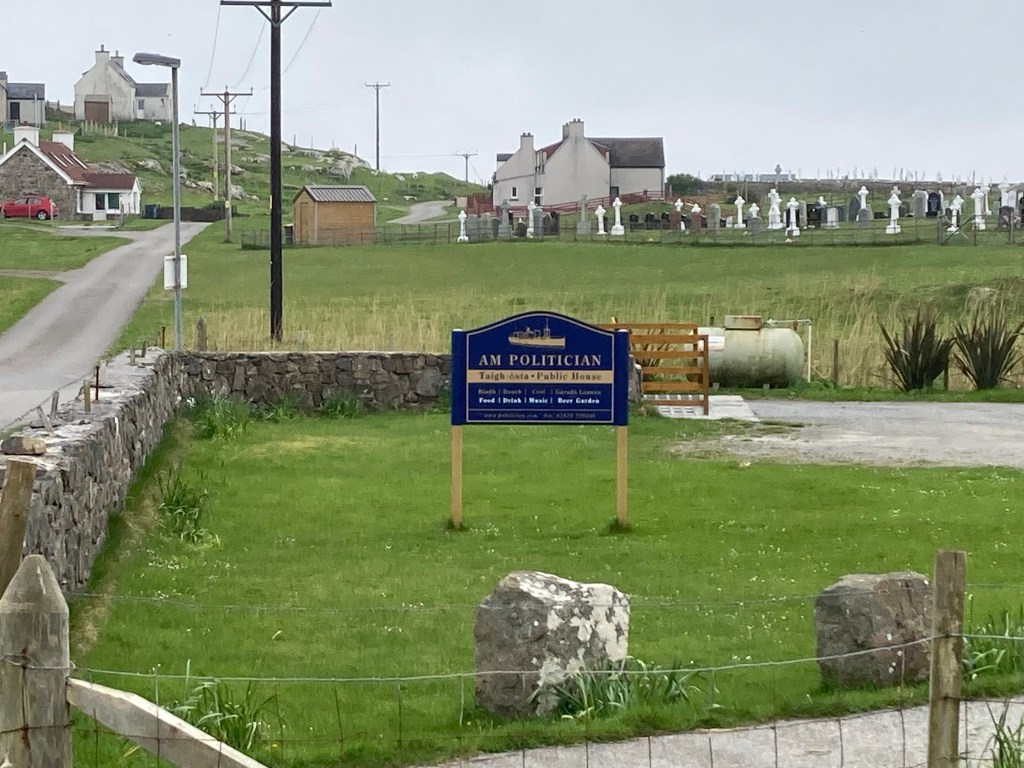
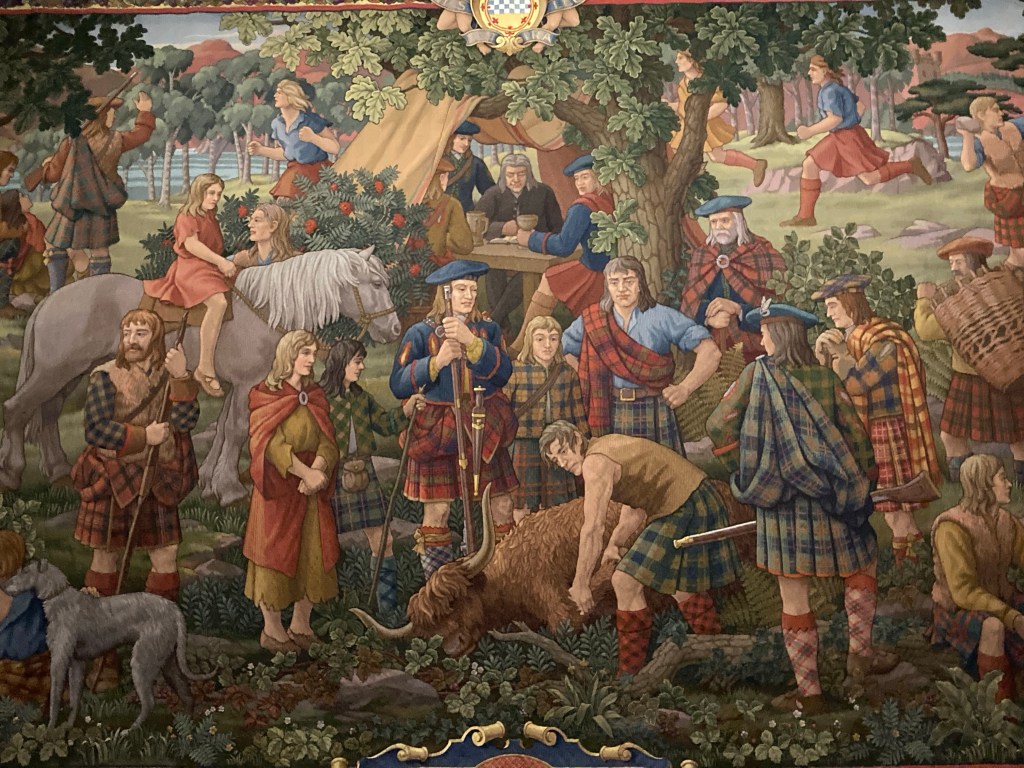
Eriskay is a small island joined to South Uist via a causeway so we decided due to the late afternoon arrival of the ferry to drive direct to the campsite on South Uist. But not before stopping at the Am Politician pub famous for having a collection of souvenirs ( including bottles of the whisky from the shipwreck made famous by the film Whisky Galore) and renowned for its good food. After dining on the largest scallops I have ever eaten we arrived and settled into camp, confused by a strange sound which we thought was the fridge we fell asleep but found ourselves waking at intervals to the same odd sound. Early morning revealed the culprit to be a male corncrake in the field behind us, intrepid photographer Charles was lucky enough to get a really good photo of the female.
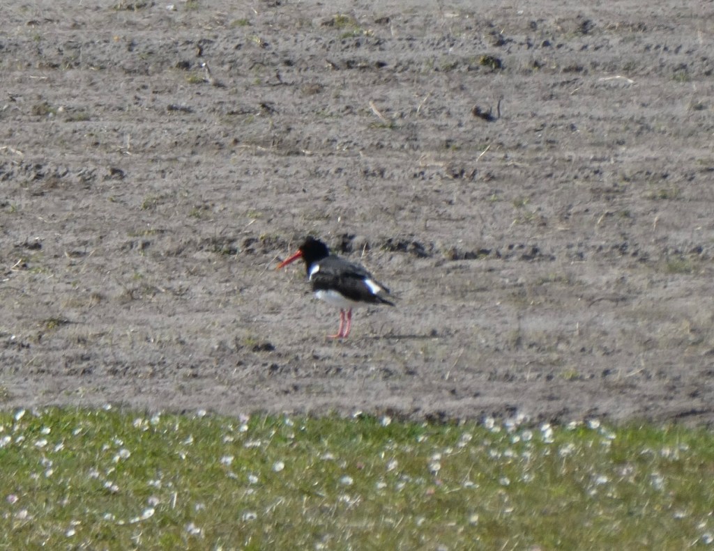
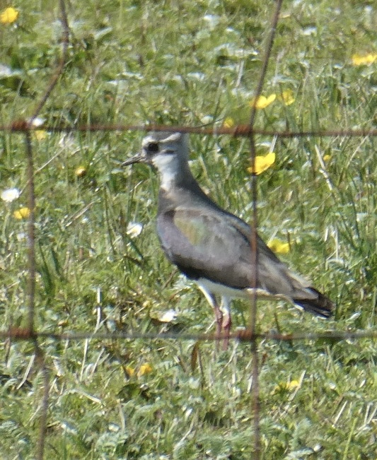
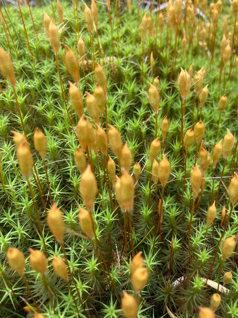
After breakfast and a shower we headed to North Boisdale and a small campsite run by a lovely lady called Katrina and Stupac the dog. Taking a circular walk along the lanes and following farm tracks around the field perimeters the variety of birds was astounding lapwings, oyster catchers, redshanks, skylarks, corn buntings and in the background the male Corncrakes constant calling.
Redshank OystercatcherLapwingCorn Bunting
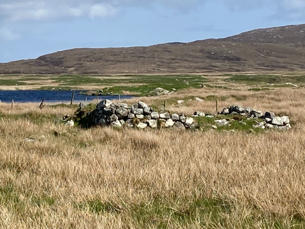
In the distance in the middle of nowhere we could see an old church and gravestones, on investigation we discovered it to be a Commonwealth graveyard.
Nth Boisdale Church with War GravesMerchant Seaman war grave
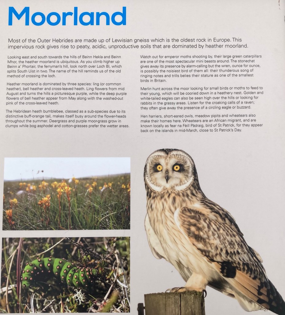
Having said goodbye to Katrina and an overzealous goodbye from Stupac we were treated to the sight of a short eared owl hunting in the field next to us as we drove but unfortunately we were unable to get a photo but can share an RSPB info board image.
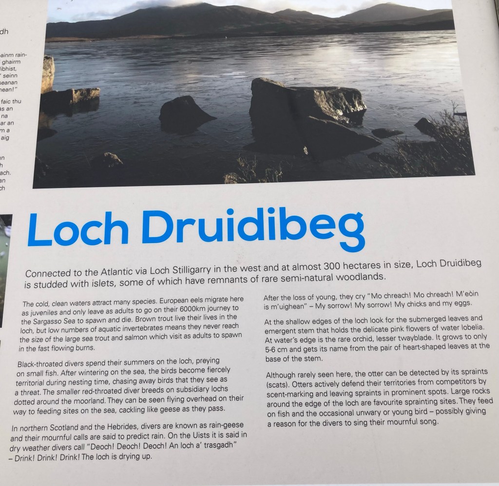
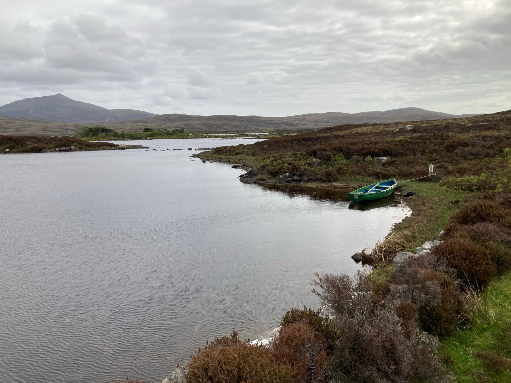
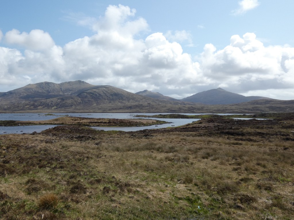
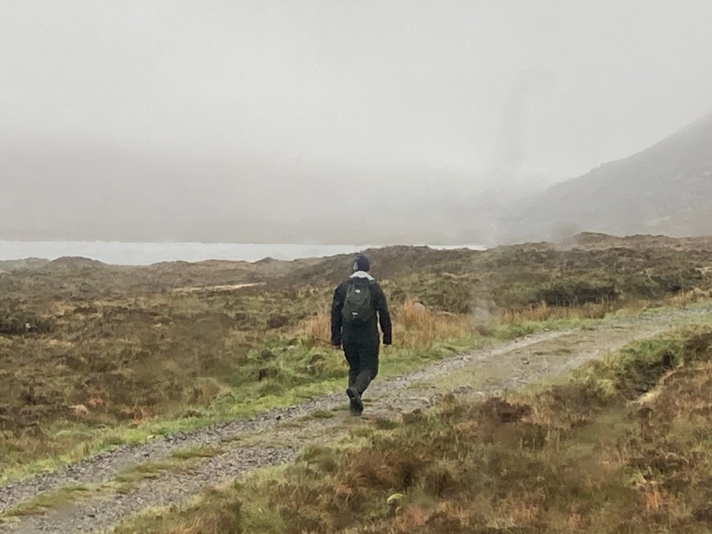
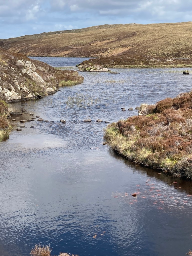
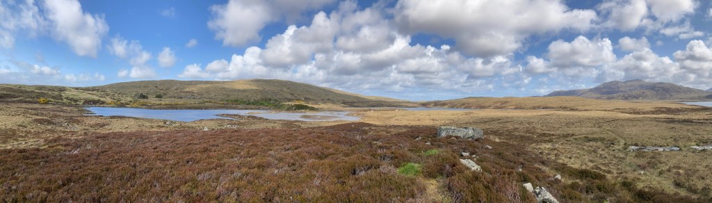
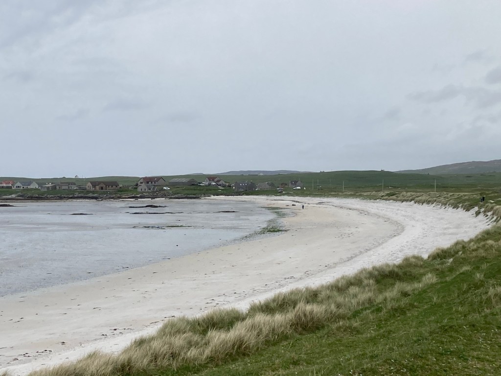
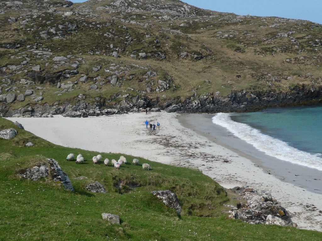
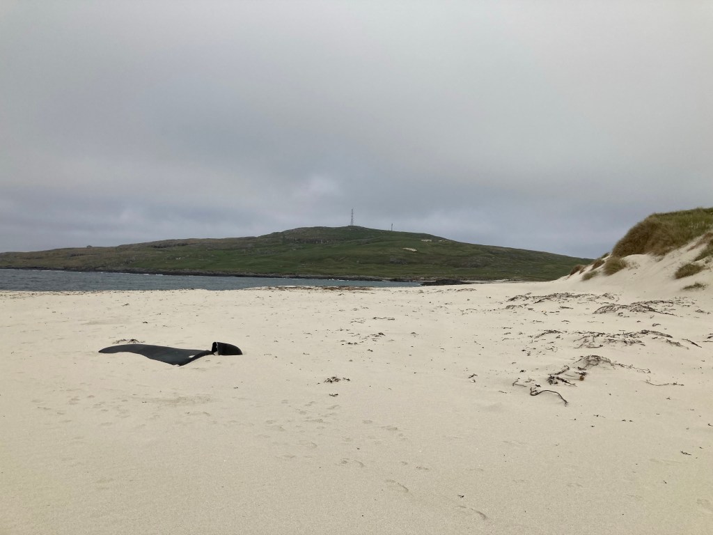
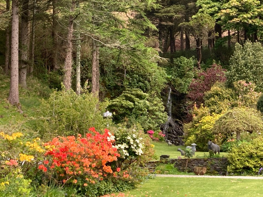
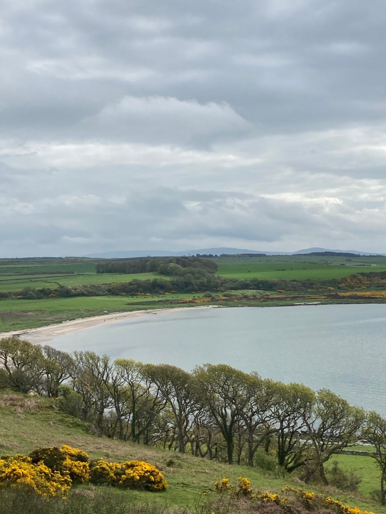
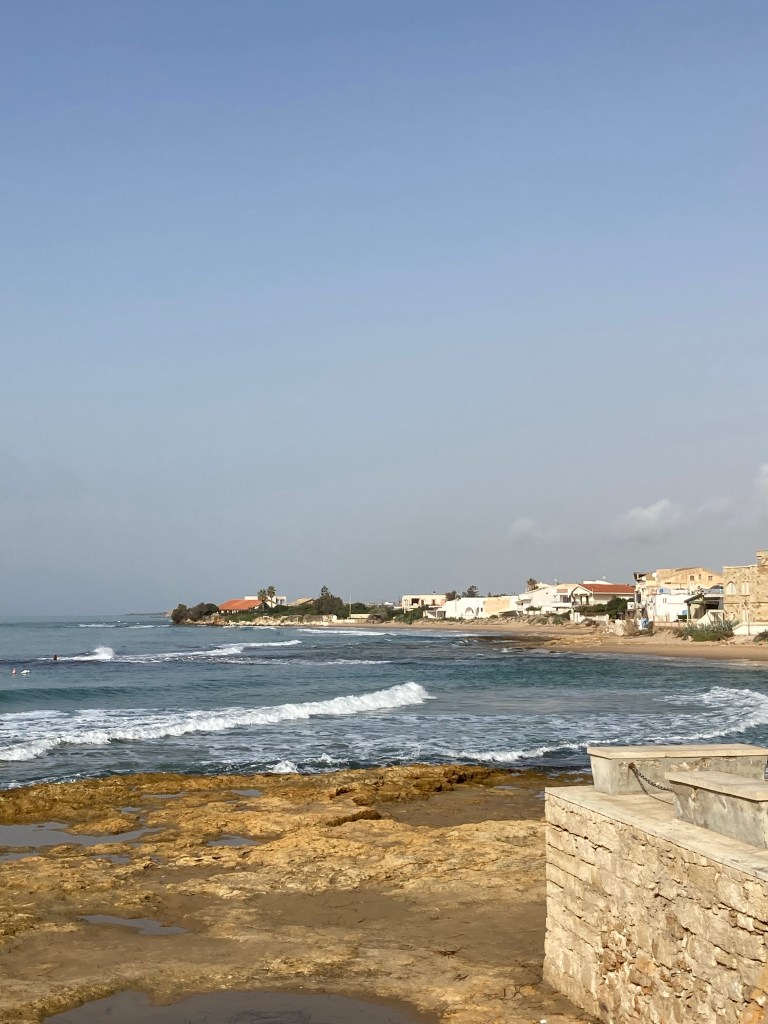
Our next stop was on an RSPB reserve next to Loch Druidibeg, following a marked footpath over the peat bogs we were treated to some spectacular views and again a variety of birds. Coming back along the road we were met by a bedraggled looking wild horse whose expression was similar to that of Eyoreout of the Pooh Bear stories. We had one more stopover at another RSPB on the west coast at Balranald. The site was overlooking a beautiful bay and we spent our time walking on the beach collecting stones and birdwatching before catching the ferry the next morning to the island of Harris and Lewis.
The two islands share the same land mass which until recently was separated by an imposing mountain range. The island of Harris is probably best known for Harris tweed and is the first we set out to explore.
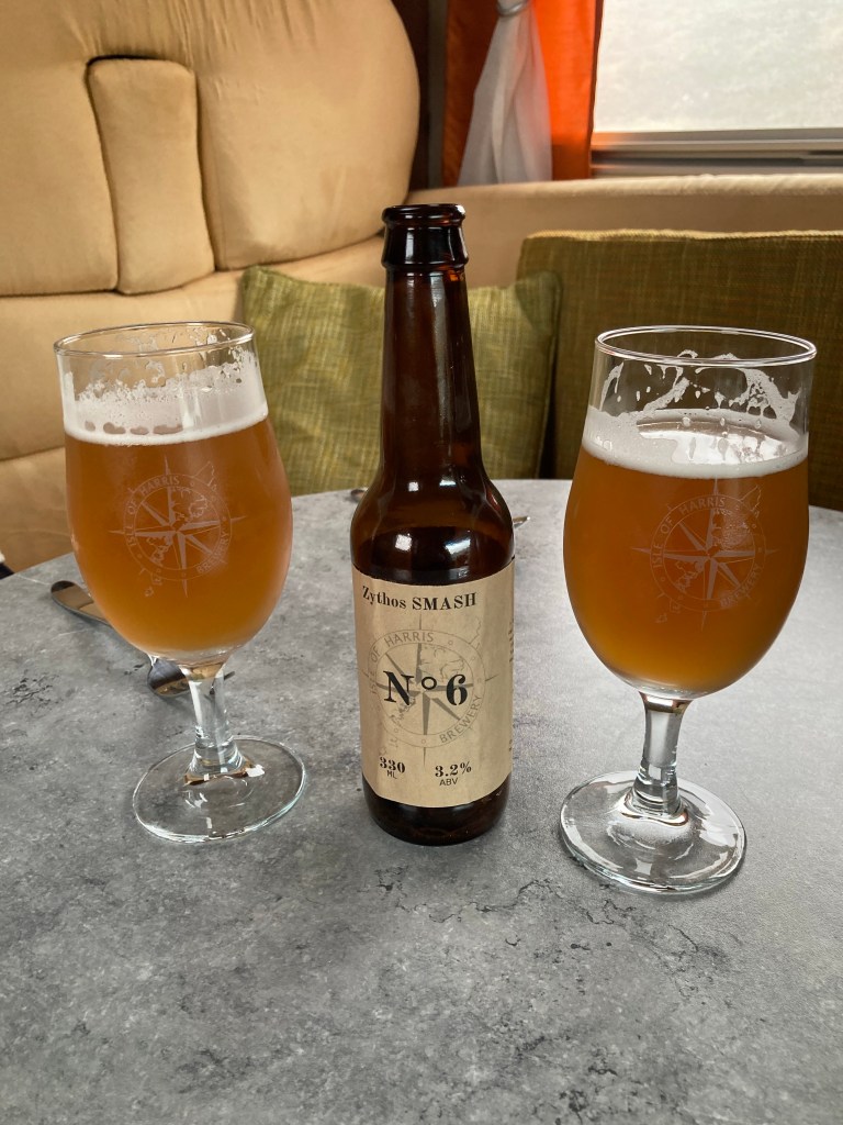
Our first destination was a small Croft brewery, (called the Isle of Harris brewery) run by Nick, Anna and Spud the Brewery Dog they specialise in sourcing unusual hops for brewing. Originating from Oxford they started the brewery only four years ago one assumes it is successful as unfortunately for us they did not have their full range in stock due to recent sales but still we managed to come away with a mixed box of a dozen bottles. Anna shared their future plans with us of distilling rum and using the empty rum barrels to store beer then alternating between rum and beer Mmm sounds an interesting combination have taken their website details so we can order on line.
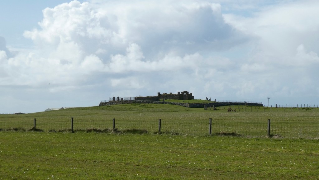
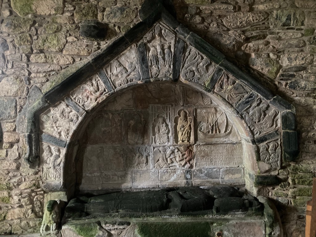
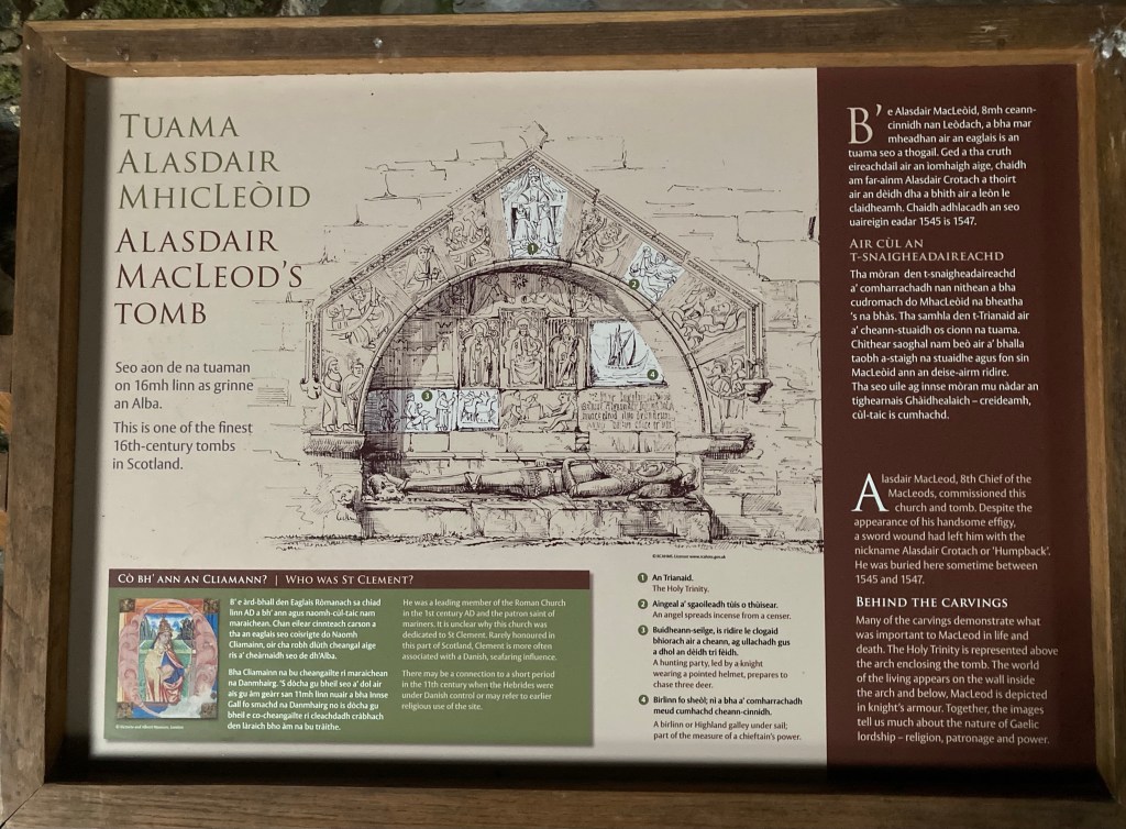
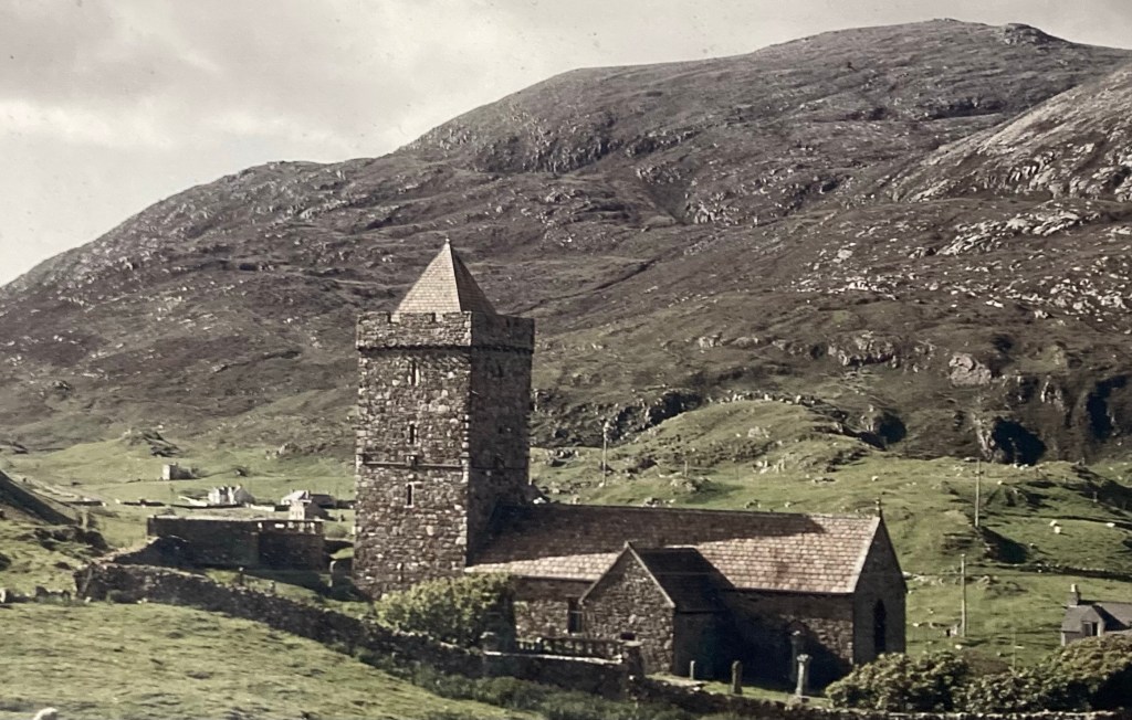
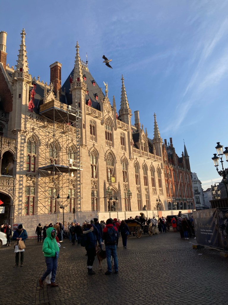
Leaving the brewery we rattled our way to the local landmark, St Clements church built in the 1520/1530s for the clan MacLeod with four of their chiefs interned within the church. It is renowned as being one of the oldest surviving complete churches and apparently it is unusual for a Scottish church to be dedicated to a female saint associated to seafarers and believed to have originated from Scandinavia. Interestingly in the 1990’s a consortium of aggregate companies wanted to create a super quarry on the island. The mountain you see in the church photo is the end of the mountain range that is approximately 4 miles long. If permission had been given the whole mountain range would have disappeared.
Heading north along the West coast we stopped off at the Seallam centre Northton which was a genealogical centre and small museum if you have Scottish heritage they will offer to trace your family tree. The museum concentrated on the history of the people and their way of life and had taken individual islanders and traced their family trees and where individuals had dispersed around the world following a potato famine and reclaiming of crofts by wealthy landowners. Interestingly the founder of the Del Monte brand was one of these individuals, many had relocated to Nova Scotia where conditions were hard but they had successfully carved out a better life for themselves.
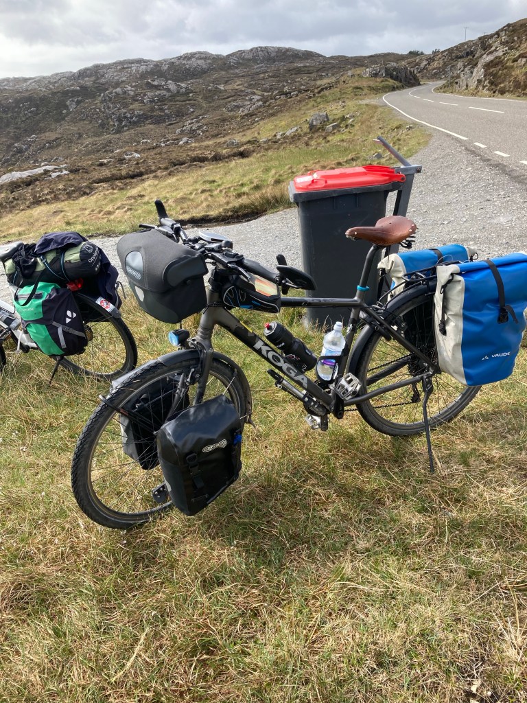
Our next stop was at Tarbet to visit the famous gin distillery. En route we stopped at a viewing point where we met Manfred and Annelise from Munich who had cycled from Newcastle to Oban, ferry to Barra and were now heading to the North tip of the Outer Hebrides before getting the ferry to Ullapool and cycling to Blair Atholl castle where they had tickets for the Highland games starting on the 25th May six days hence. We were greatly impressed by them as they had a few years on us and were basically carrying their home in their bike panniers no luxury of a sizeable camper van for them! Disappointed by the gin tasting at the distillery we took solace in the cafe consoled by the largest and tastiest of chocolate brownies and a coffee. As we returned to Vinnie we bumped into Manfred again looking a little bewildered as he had lost Annalise ( I think she had sneaked in on the distillery tour 🤪 ) we didn’t stay long enough to see if he found her.
German for travelling light
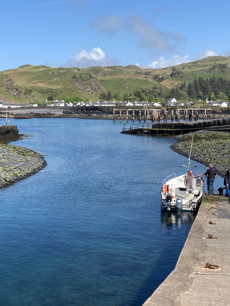
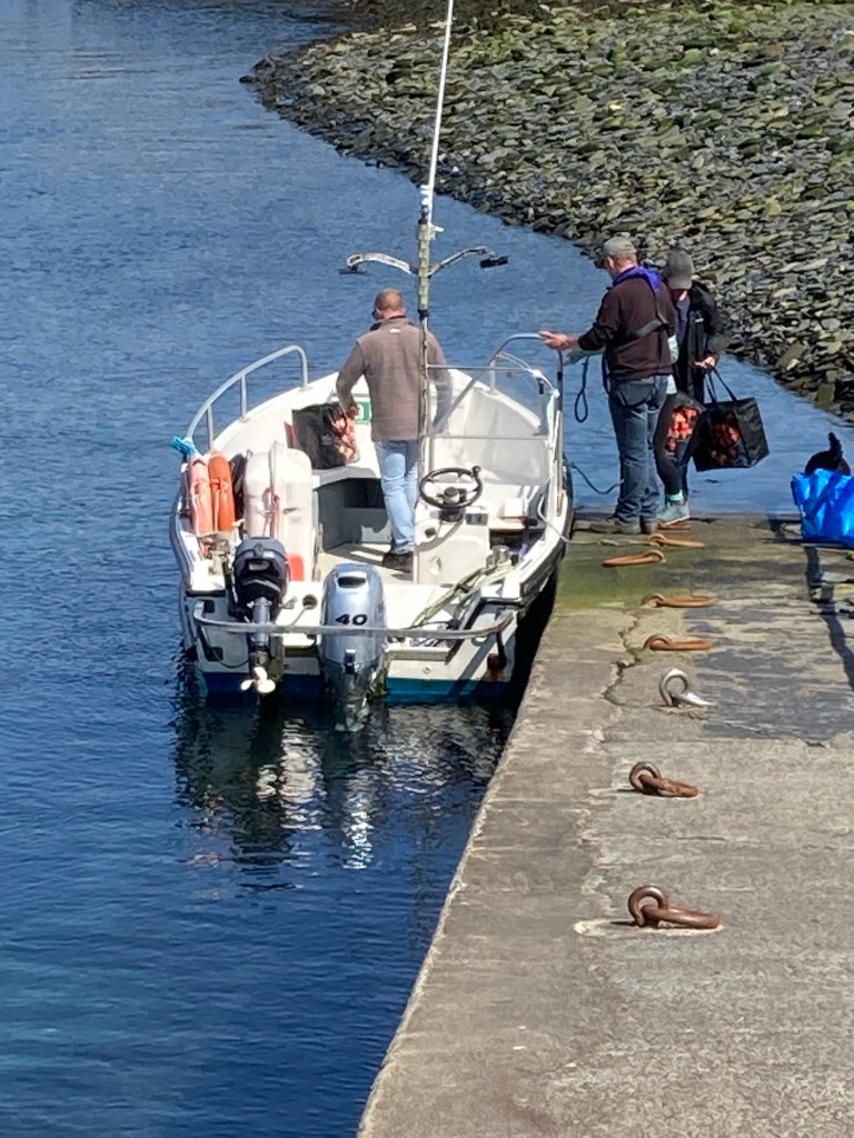
East of Tarbet was the small island of Scalpay famous for having the first lighthouse on the Hebrides. Parking Vinnie we got talking to three men who were sailing from Northern Ireland up through the Hebrides, they had been waiting for a taxi for quarter of an hour and were getting a little anxious as they needed to get back on board before the tide turned and were a little sceptical on the reliability of the taxi after the driver had asked them which house they needed picking up from? They started walking.
Eilean Glas lighthouse
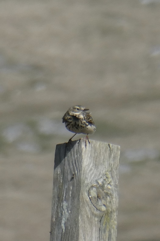
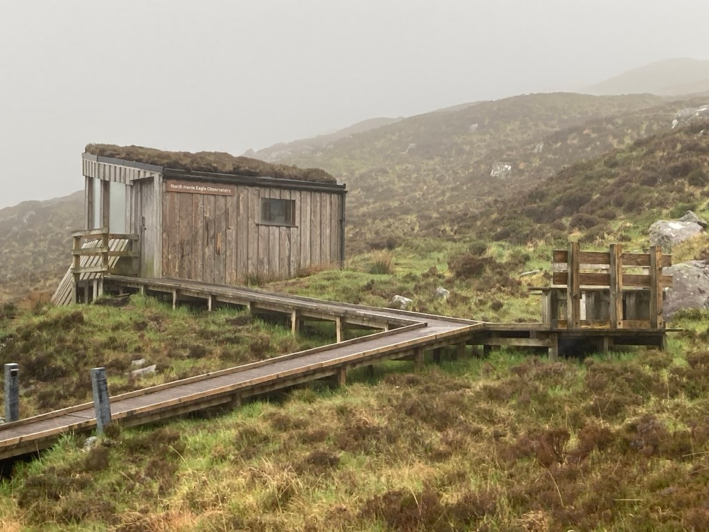
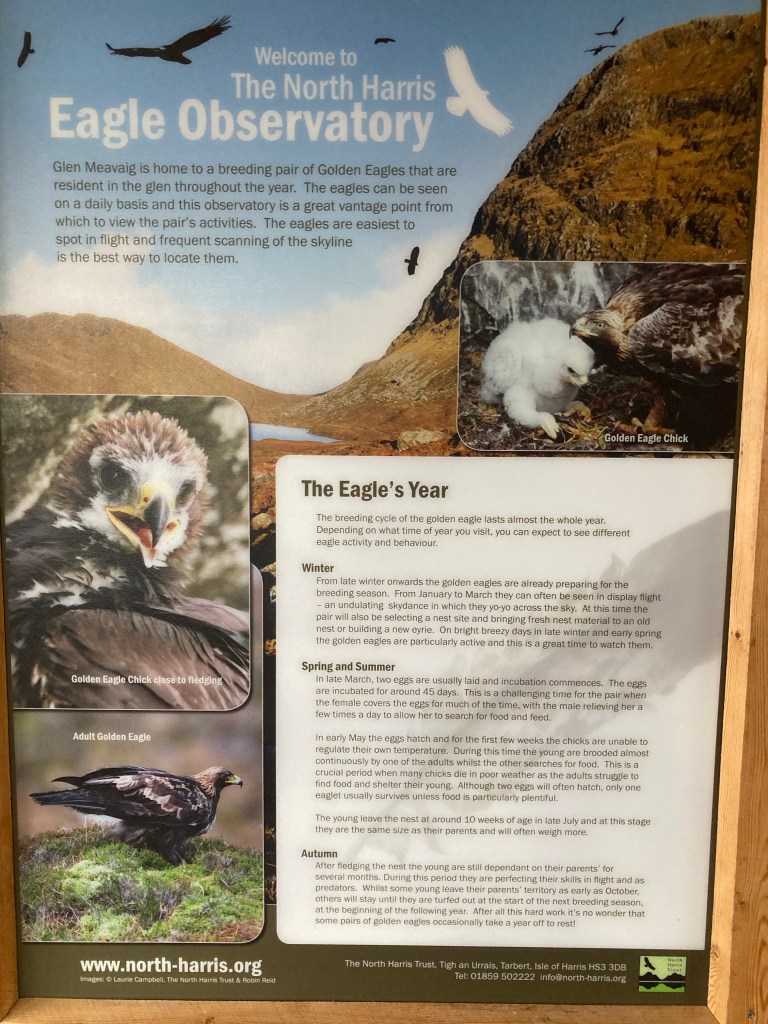
From Scalpay we continued along the West coast parking up overnight at the start of a footpath leading up to The Eagles nest where there was a hide from which you could hopefully spot the resident pair of Golden Eagles.The following morning despite having low cloud we set off hoping the early birds would catch the worm having got up at 6am!! No such luck as fast as the clouds started to clear they would drop again and obscure any view. After an hour and a half we gave up but not before having spent an interesting twenty minutes or more chatting to a local volunteer who was doing a breeding bird survey for the south Harris area. Battling our way back through head on wind and rain we were thankful not to be Manfred and Annalise as we had the comfort of a warm van and dry clothes to change into.
Bird survey volunteer
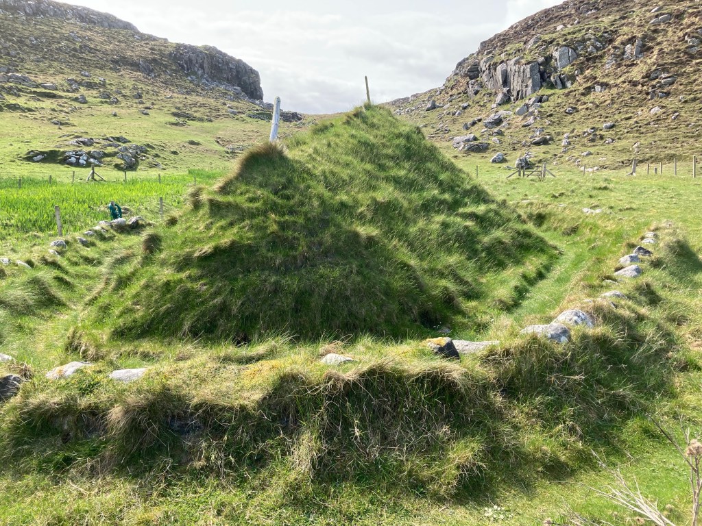
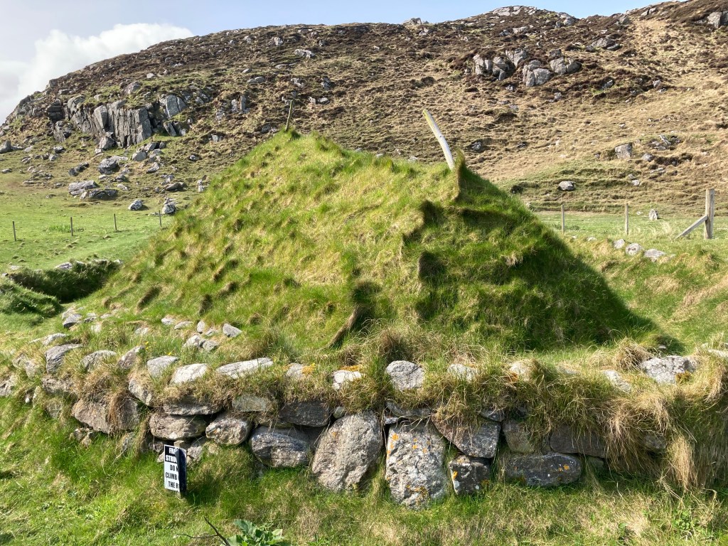
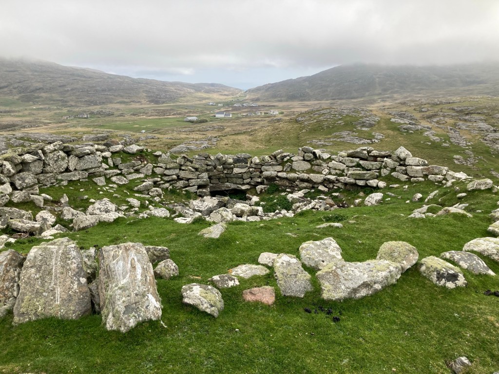
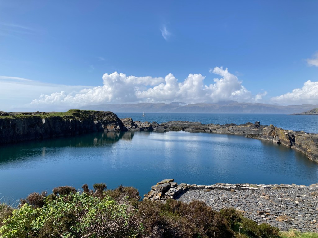
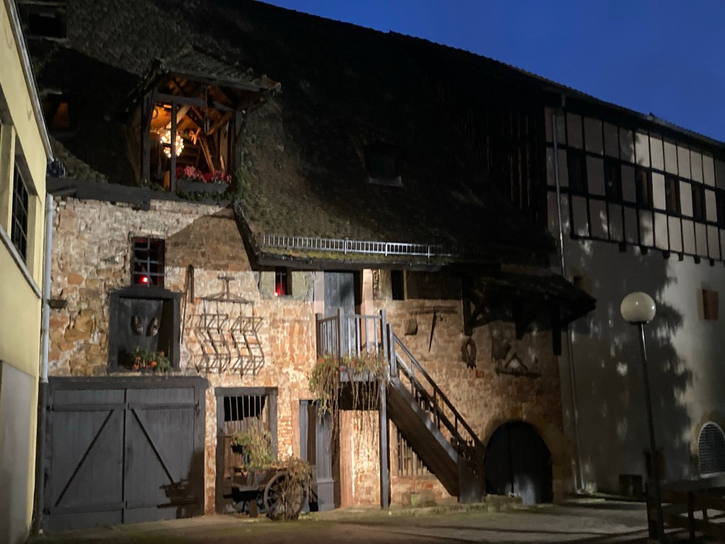
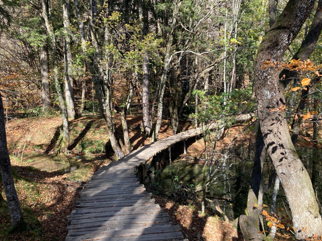
There are a number of smaller islands making up the outer Hebrides,often linked to larger neighbours by causeways or bridges, and our next stop at Bortha Bay was on one of these called Great Bernera (which was linked to Harris by a new bridge) to see an Iron Age house which was part of the most completely preserved Iron Age village ever found in Scotland. The site had remains of 9 stone buildings in varying condition but all connected by tunnels! The village was only revealed in 1993 after a massive storm and high tide had stripped an area of sand dunes just off the beach.
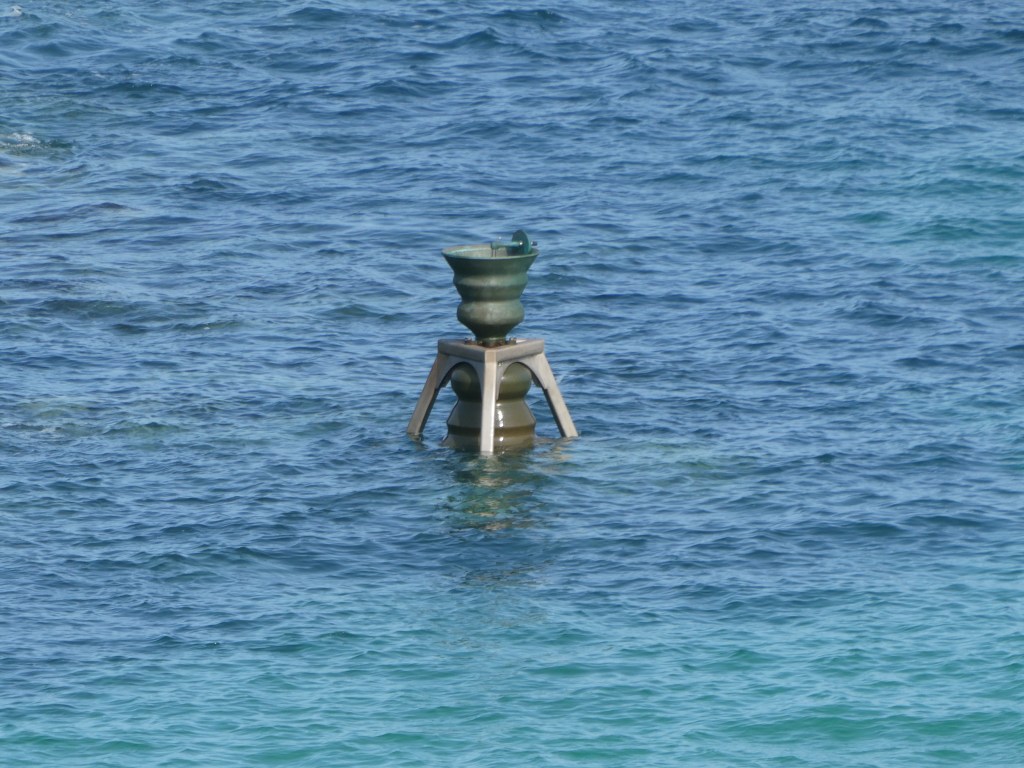
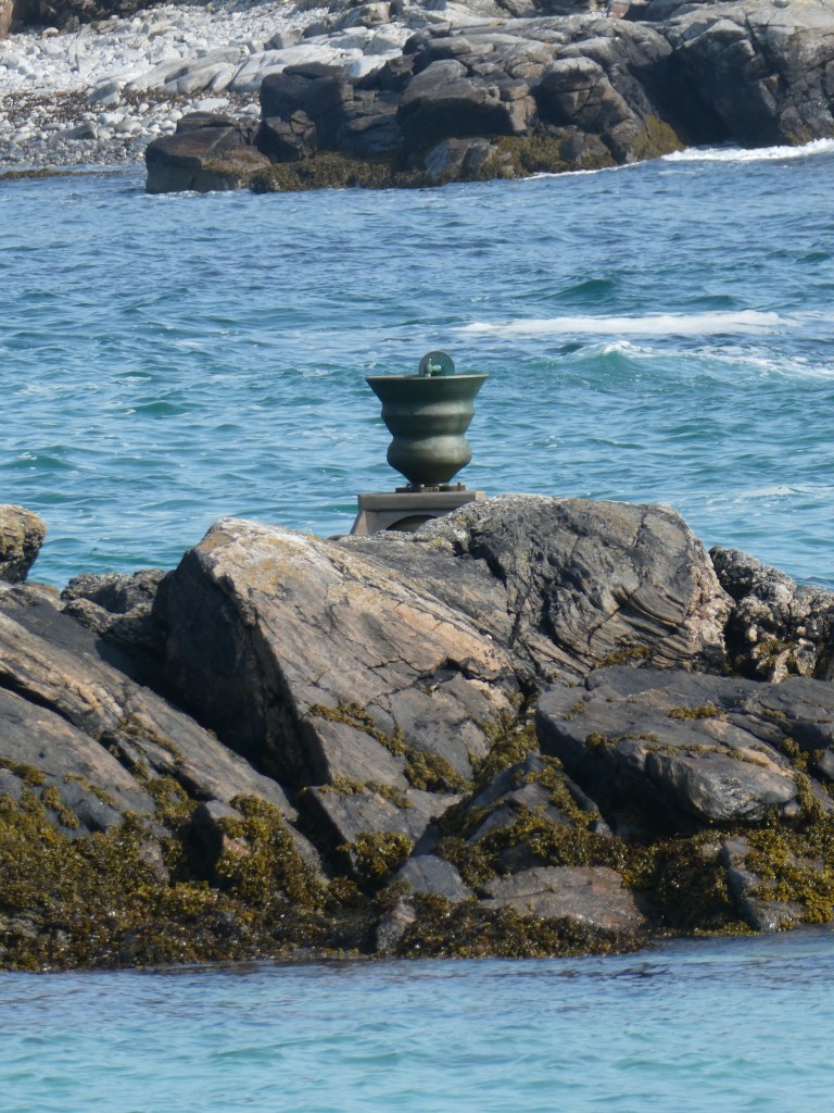
At the other end of the small bay was the Time and Tide Bell which is part of an art project made up of bells, designed by UK sculptor Marcus Vergette and Australian bell designer Neil McLachlan, there will be a total of 16 bells installed at coastal locations in the UK. The first one was placed at Appledore, Devon, in 2009 with this one at Bortha bay being installed in 2010. Each bell rings around high tide; the bells provide a reminder that rising sea levels will make the pattern of their ringing change. There is every chance that some of the bells will have to be relocated in the twenty-first century.
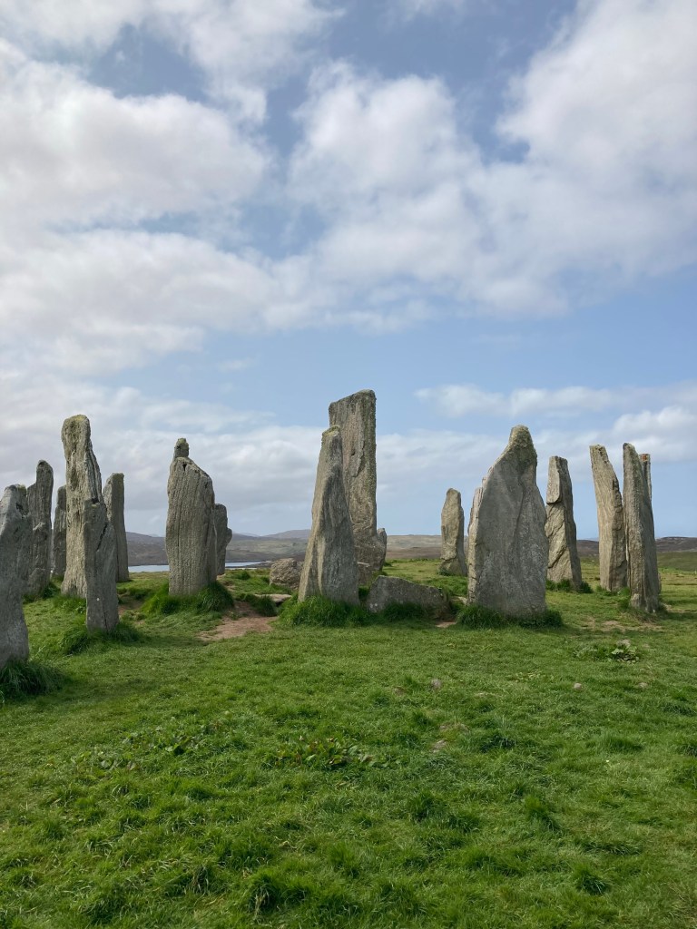
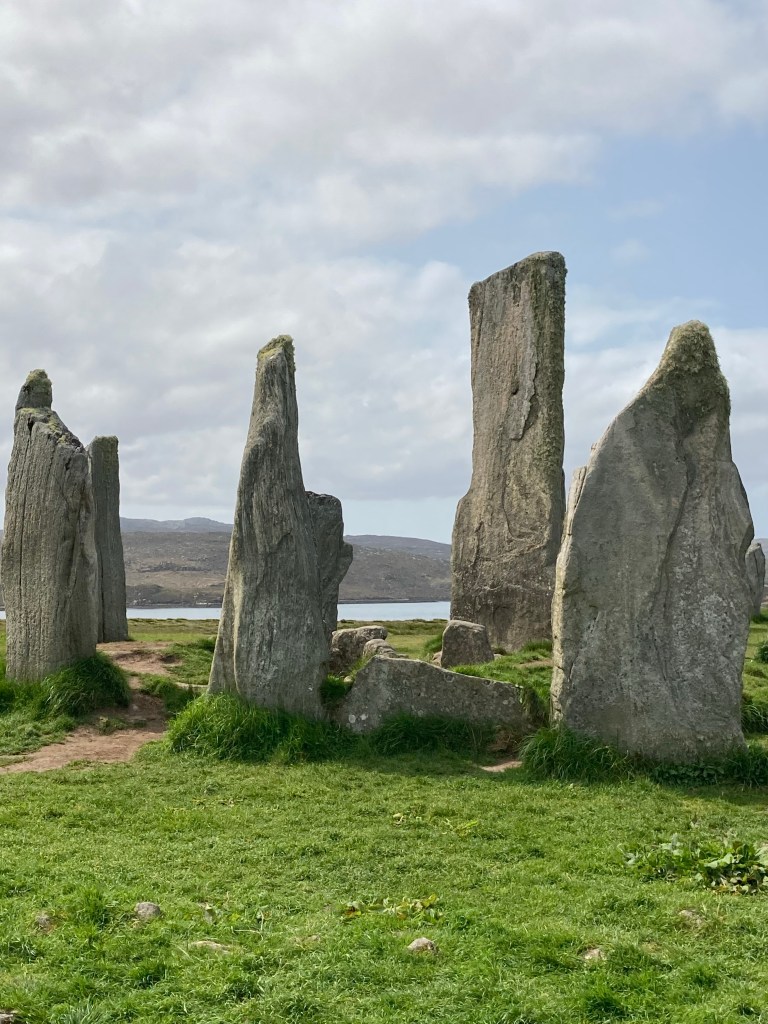
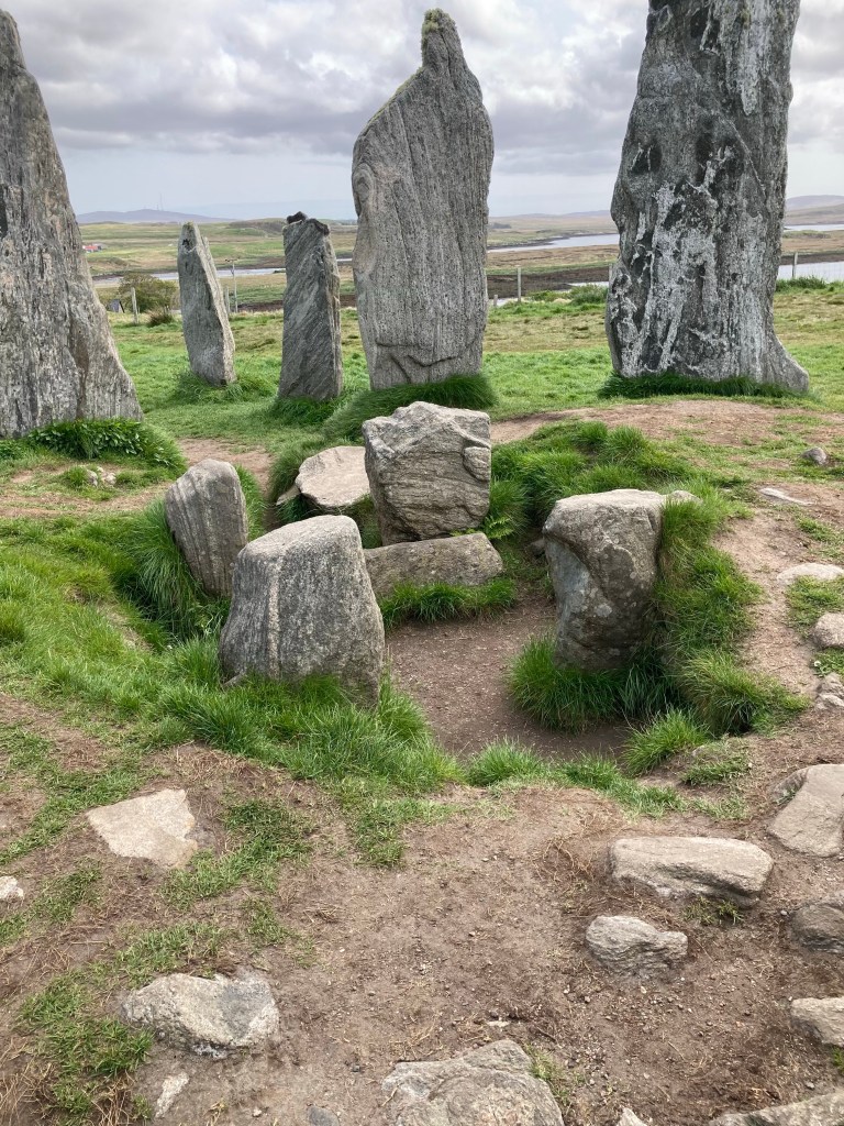
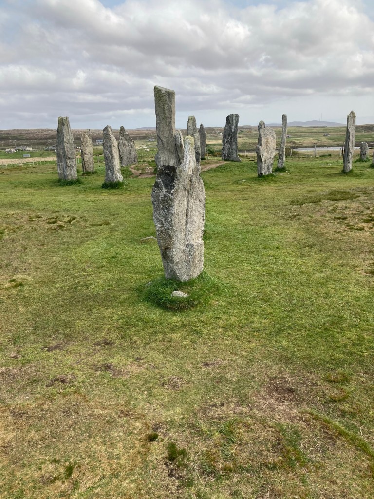
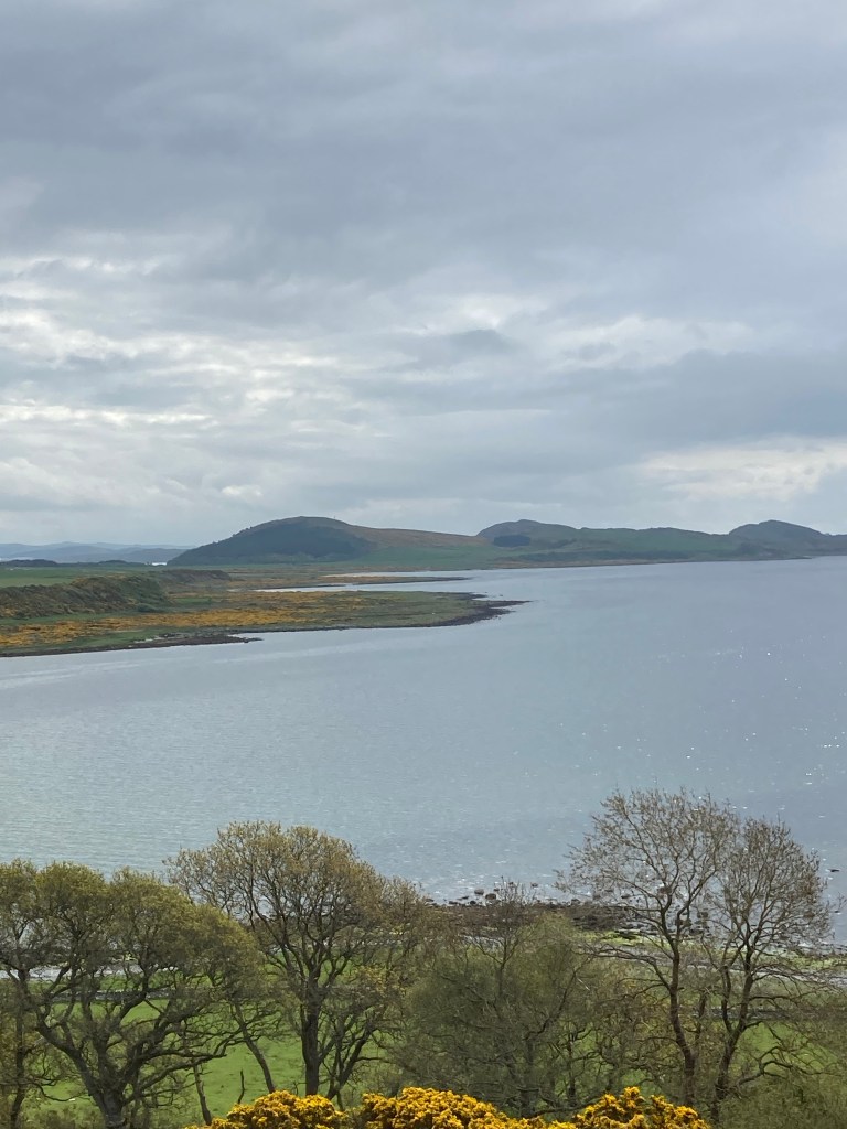
After leaving Great Bernera we went further up the Lewis coast stopping off to see the Callanish standing stones of which there are around fifty on the main site at the visitors centre dating back 5000 years. There are also two other sites which we passed on the way thinking the visitors centre would have all the information forgetting that everything closes on a Sunday.
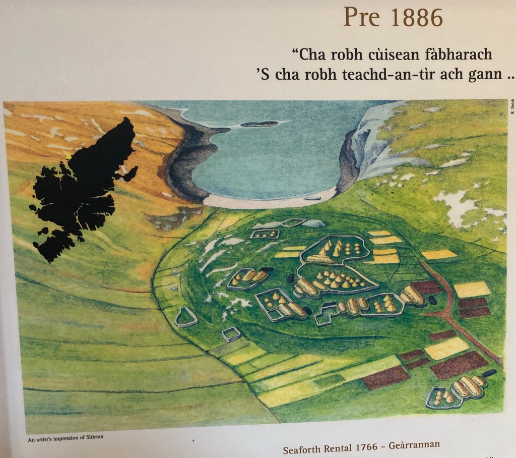
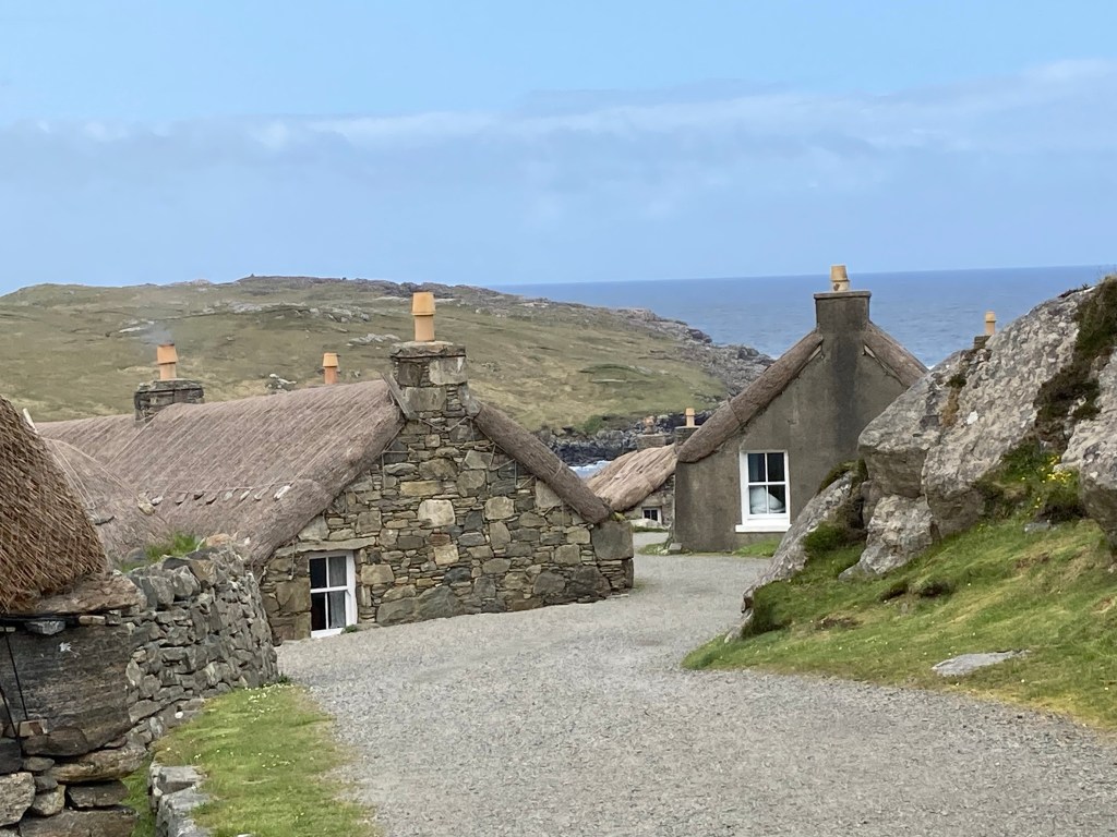
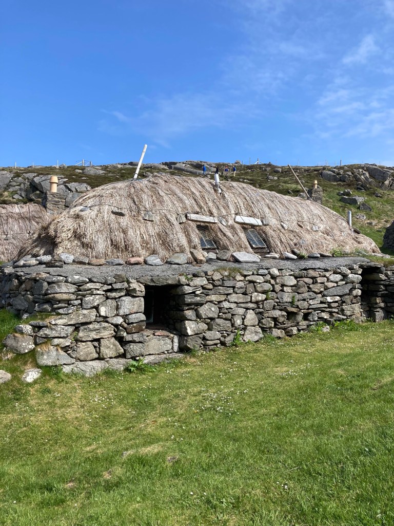
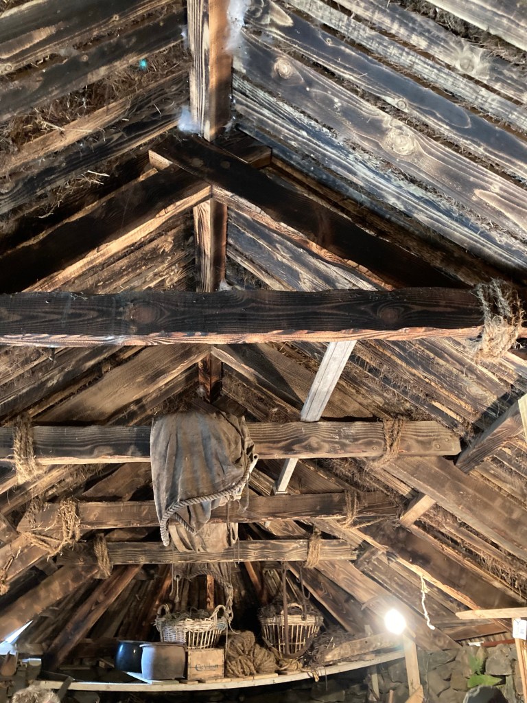
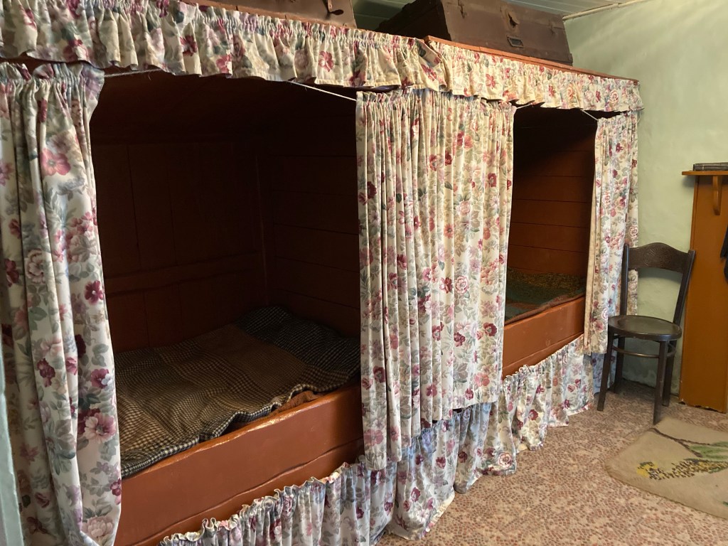
The following day before heading to Tiumpan Head which is east of Stornaway we visited The Black house at Arnol. A well preserved link to the past showing how a community lived a very basic lifestyle, the last inhabitant having left the village in 1975. There was evidence on this location of human settlement going back about 2000 years with the current layout being several hundred years old. The villagers had made a living for many generations from seafaring activities (fishing, whaling and naval) as well as weaving of Harris tweed. In one of the houses there remained a working example of a mechanised hand loom. This had been developed to make the islanders work more efficient and competitive for overseas markets yet still required the weaving to be hand operated so comply with the patent on Harris tweed of being hand made.
We had hoped to see whales and dolphins at Tiumpan Head but a windy cloudy morning had revealed nothing according to a guide we spoke to. We decided to brave it out for about an hour and yes saw the back of a dolphin swimming just below us but sadly no whales. The location was well known for having Minke and killer whales and around five species of Dolphins which were commonly seen in the area. Having decided to give up we headed for the Ferry to Ullapool, we were booked for the following day but thought we would chance getting on as a standby and .Lady Luck was with us and we were allowed to board.
As we finally depart the Outer Hebrides it would be an injustice if we did not share some photos and words that try to capture what we have seen on our 12 day journey from Vesteray in the South through to Lewis in the North
Undertaking this journey as recent as the 1970/80s would have been completely different as not all the causeways in use today existed. This journey through the Outer Hebrides required 3 ferry crossings as we have travelled its length. Back then there would have been 13 to undertake if you had taken our journey. Maybe the land mass broken into islands gives a history that goes some way to explain the sense of similar but not the same that we experienced.
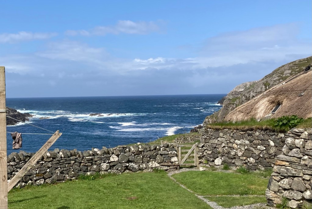
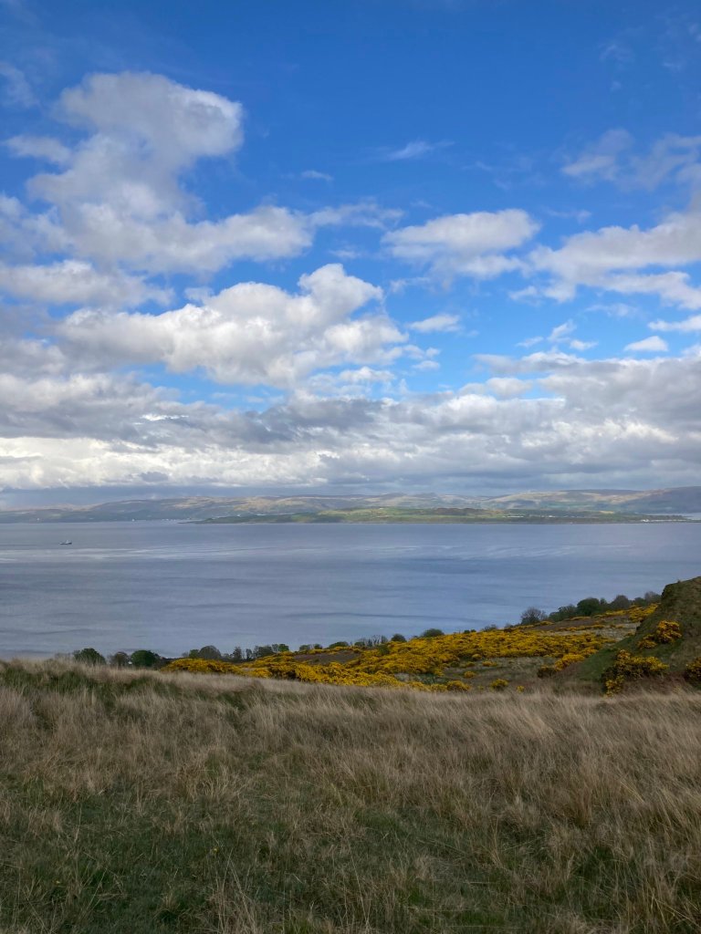
What they do all have in common though is a western shoreline that non stop provides a musical backdrop from waves crashing and wind sounding soft one moment and threatening the next. But then the majority of the western shoreline is looking out towards the eastern seaboard of America, Canada and Greenland so the wind and waves travel a long way.
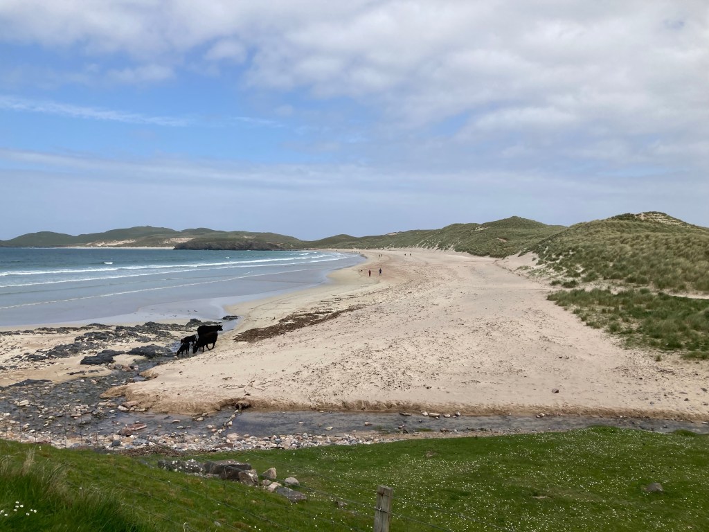
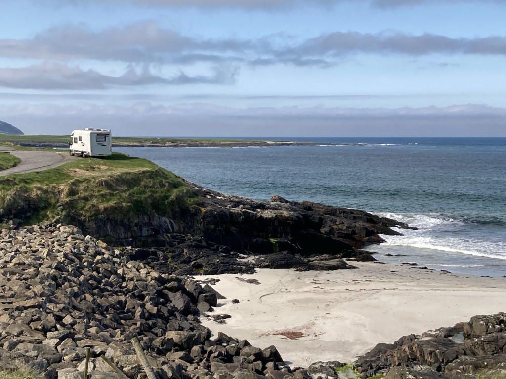
Surprisingly for a part of the United Kingdom we associate with rain and cold, the beaches are blessed with tropical looking seas that range in colour from an aquamarine green through to blue and sands that went from white to various shades of yellow. If only the sun was more consistent!
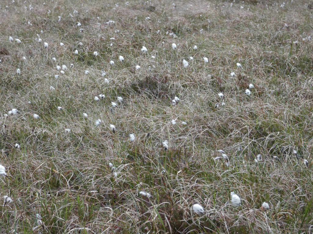
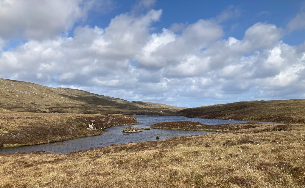
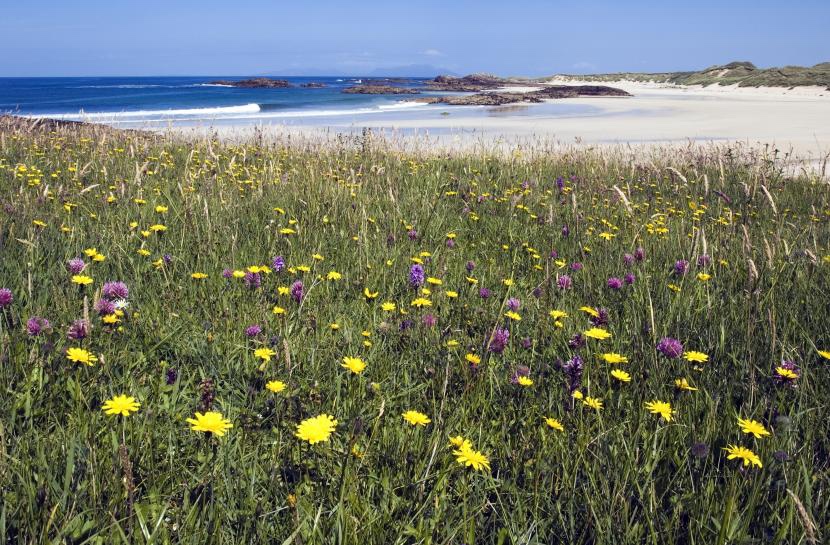
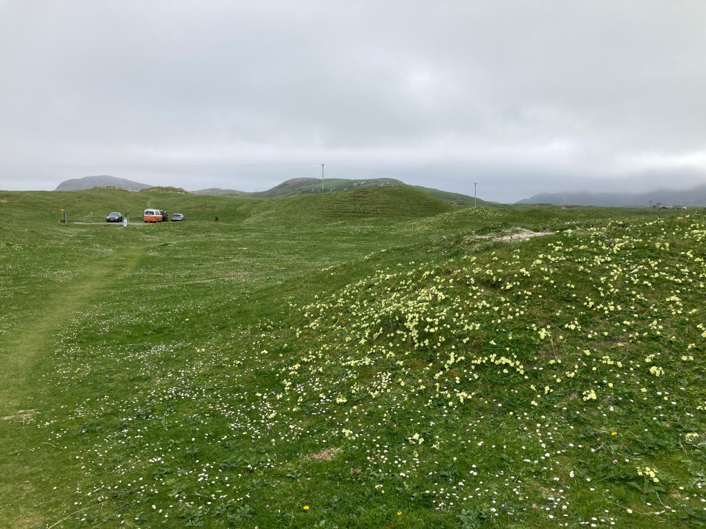
The landscape is just as varied being a mix of rocky outcrops and strong hill ranges in places, with peat fields and bogs extending as far as the eye can see, The peat fields still provide a source of fuel to the islanders with a common sight as we drove around being areas of peat cutting with turves laid out to dry. This dramatic landscape of hill, moors and bogs is then fringed with low lying coastal crofting areas that contain the amazing Machair.
Machair is a Gaelic word and is more than a habitat, it is a blend of:
low-lying coastline
sand partly consisting of shell fragments
the effects of strong winds
just the right amount of rainfall
the involvement of people and their grazing animals
Scotland’s machair is best developed on the Uists, Tiree and Barra.
Isle of VatersayIsle of Seil waterbus to EasdaleIsle of BarraNorth UistLuskentyre West HarrisLuskentyre at sunsetSeaforthBortha Bay surf West LewisBortha Bay
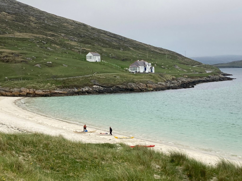
Taking the ferry from Oban we landed on the island of Barra in the early hours of the evening and headed for a designated wild camping space on the western side of the island. Wow had we struck lucky wild crashing waves greeted us and spectacular views over the bay we loved it so much we spent a couple of nights here.
Taking a day time hike we discovered an Iron Age fortified house on top of a hill then dropping down onto the beach found ourselves in close proximity to nesting terns and ringed plovers. To avoid disturbing them we diverted into the sand dunes to find our way back to Vinnie.
The following morning having read a lot on social media about the most southerly populated Outer Hebridean island of Vesteray that has the unique feature in the middle of the island where it narrows to sand dunes with back to back beaches.We decided it was worth a visit but on arrival due to the weather conditions decided it was not for us and decided to head to the north of the island.
En route we passed the ferry terminal and with all the upheaval with ferries and when trying to book our ongoing ferry for Eriskay which was linked by a Causway to south Uist had found there was no access to a booking service on line until the Tuesday four days hence, we decided to go in to the ferry terminal and try and book direct. Finding there was no office service and no staff we thought let’s try our luck and see if we can get on the next ferry out which was leaving within the hour. Yes, no problem on we went with no ticket and no one wanting to take our money either on the ferry or as we drove off the other side so a double bonus of the ferry and a free ride 👍 The only regret was not getting to see the northern end of the island but we have learned that the ferry service in and around the islands are unreliable so you take your chances when you can.
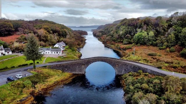
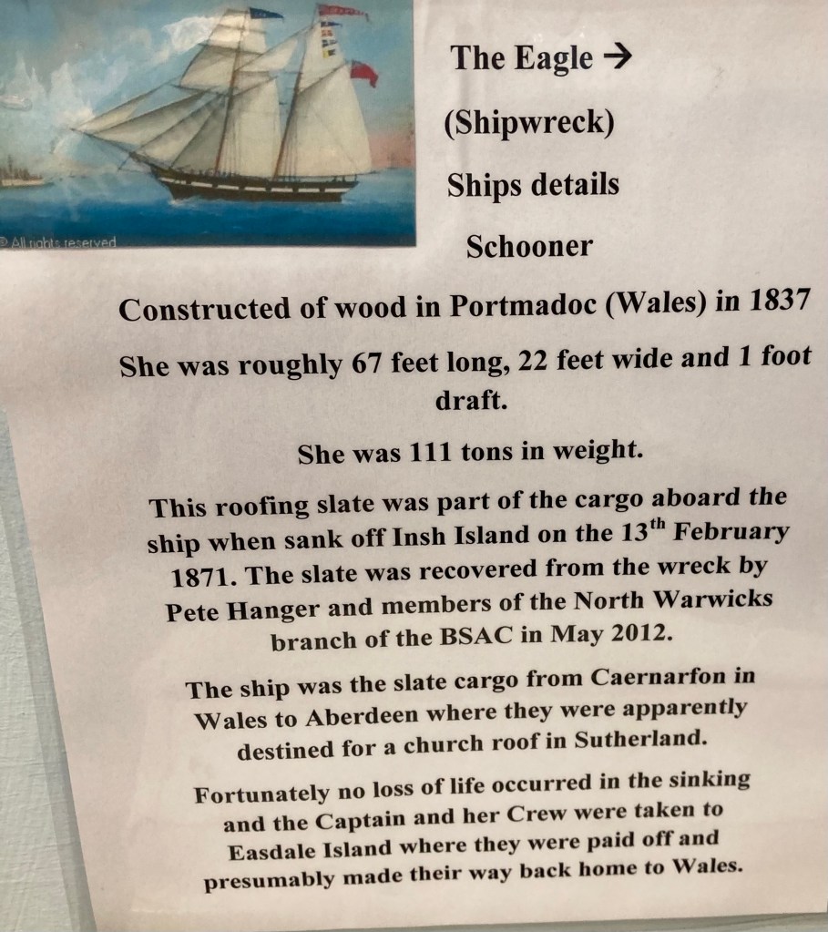
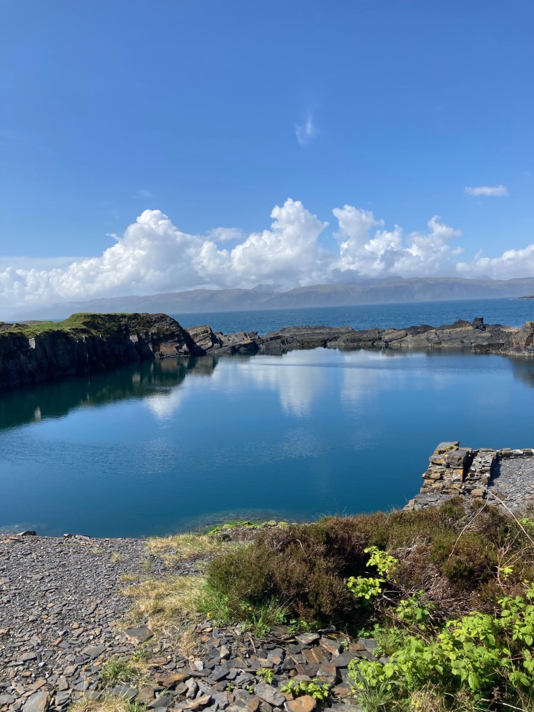
Charles had seen on social media an article on the lesser visited island of Siel around forty minutes south of Oban. Linking Siel to the mainland is the Clachan bridge which spans the Clachan sound, both ends of the sound spill into the Atlantic Ocean giving the bridge its more common name “The bridge over the Atlantic”. In the month of May the bridge becomes a blaze of colour due to the fairy foxgloves that come into full bloom.
Historically Siel and its neighbouring islands ( known as the slate islands) were the major producers of slate roofing tiles distributed around the world. We stayed at Elenabech a Scottish heritage site consisting mainly of old Quarrymen’s cottages with a small two roomed museum, shop and pub. Yet again we were impressed by the amount of information and the displays within the museum.
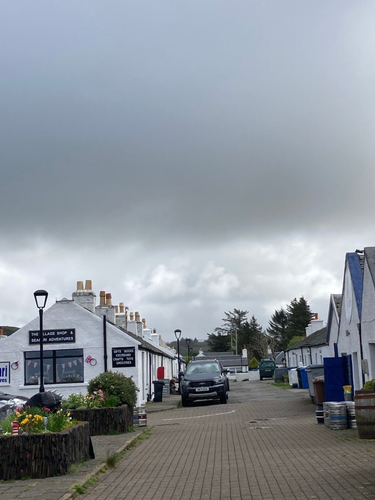
Ellenabeich main st
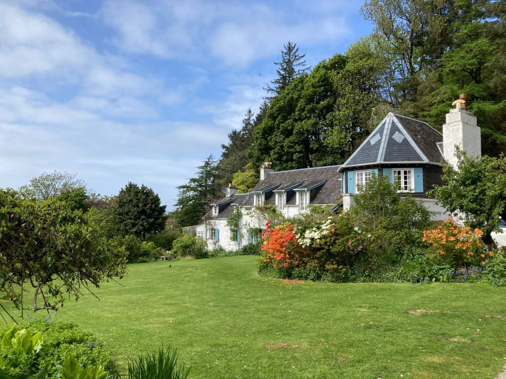
A short walk out of the village, An Clana house was hosting an open garden in aid of cancer. What a beautiful setting for a very understated house and garden overlooking the water with a backdrop of pine trees.
A short boat ride across the water from the harbour at Elenabech took us to Easdale island where nature had started to reclaim the old quarry workings. With a population of fifty two people there were few houses again mainly old quarrymen cottages with a few new builds. As there are no cars or roads on the island it was a pleasure to take a walk around the island which had many paths around the perimeter of the old workings.
These 2 locations along with a number of near neighbouring islands had been the heart of this Scottish slate industry around the mid 1800’s and at its height employed 250 people. It was competition from other slate producers in the U.K. and Spain and severe winter storms breaching the quarry walls that destroyed the industry. The mining on these islands was by digging into the island rock to a depth in places of up to 200 feet below sea level and leaving the edge of the island reduced in thickness which is where the breach occurred. One such quarry had contained a volcanic lava extrusion in the slate seam but they had quarried around it leaving a eerie shape in the flooded quarry.
Our next planned island hop was to Islay and Jura so taking a couple of short drive on/off ferries onto the mainland we positioned ourselves north of Campbeltown with a view of visiting the CalMac booking office to obtain tickets. Annoyingly the offices were closed and after several attempts Charles managed to log onto their site which had posted a statement that due to breakdowns and necessary repairs they were only able to offer a limited service with preference given to local residents and commercial vehicles meaning currently there were no ferries to Islay 😥
So undaunted we did a quick rethink and decided to head to Oban and take a ferry to the Outer Hebridean island of Barra and managed to book ourselves a ferry space online. So onwards and upwards
We were greeted on our first island the Island of Bute by high winds that battered poor Vinnie throughout the night resulting in a night of intermittent sleep mesmerised by the sound of the wind.
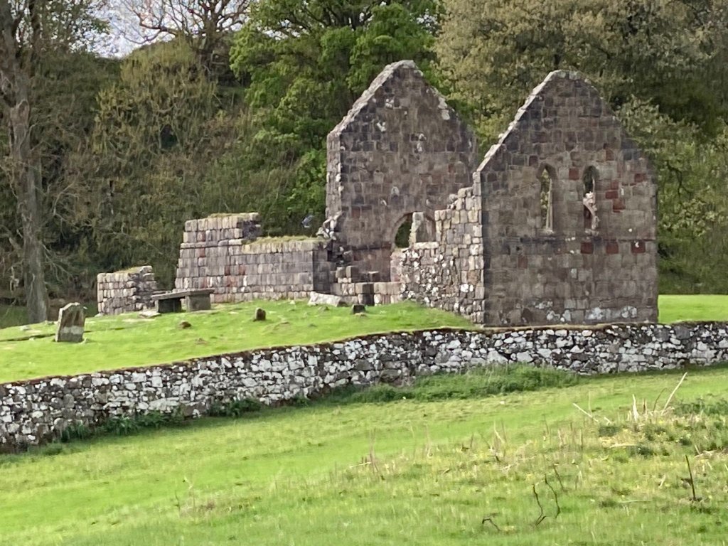
After a really blustery night we were met with a calm sunny sky and headed off along a coastal walk, a little precarious in places where the footpath had been eroded but well worth the views. Passing along the way inland lakes and St Blanes church which originated in the early 1200s and then destroyed by the Vikings and rebuilt by the Archbishop of Paisley but is now in total ruins.
The following morning we drove the coast road exploring the western beaches of Bute including Scalpsie Bay. Interestingly at a viewpoint on the northern side of the bay you could see where an early volcanic eruption on the nearby island of Arran had sent a larva flow along the highland fault line which cuts the island of Bute diagonally from Rothesay to Scalpsie. To the north of this line the rock is shist and to the south is old red sandstone. We continued our drive around the coast into Rothesay the main town of the island. In its day it had obviously been a thriving major holiday resort for visitors from Glasgow and other mainland towns. Sadly like a lot of bustling Victorian seaside towns it has suffered with the loss of the tourist trade. The Pavilion a grand building which in its day hosted dances for the visitors is now in ruins but undergoing a major refurbishment. Despite this the town still has a sense of vibrancy. As always we had to visit the local museum which was extremely interesting highlighting the many famous people connected to the island ie the founder of Dobbie’s garden centre originated here as did the leader of the Scottish co- operative movement, Andrew Baird who designed and built his own monoplane married a local girl and moved to the island and Birdie Bower one of Scott’s explorers had a mother and sister who moved to the island so he visited often and did a lot of his training on the island.
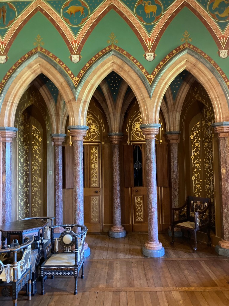
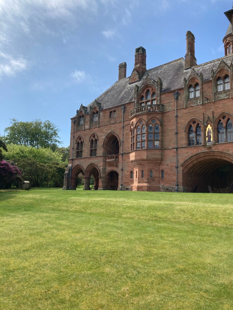
Before leaving the island we visited Mount Stuart, home of the Marquess of Bute which was approached by what seemed like an endless tarmac drive flanked on both sides by a hedgerow of the most beautiful yellow mollus azaleas. The house itself was gothic in design and one of the grandest I have visited. Entry was on timed tickets accompanied by a tour guide so as we had an hour to wait we went for a stroll around the “wee” garden five acres? The tour was certainly enhanced by our guide who had a wealth of information at his fingertips which he shared with a good sense of humour. Originally started as a Georgian property in 1719 but burnt down in the late 1870s and rebuilt in its current Victorian gothic style. It is the family seat of the Stuarts of Bute who are an incredibly wealthy family their fortune coming from the entrepreneurial activities of the first marquess who amongst other things built Cardiff docks and controlled all trade going in and out of the docks.
We both loved the island which appeared to have a great sense of community a really good and regular bus service, beautiful scenery and overall a sense of tranquility. Would recommend to anyone and would definitely return.
After leaving Greece we made our way from Brindisi port to Villa San Giovanni port on the very toe of mainland Italy for the ferry to Sicily. We had planned to island hop Sicily – Sardinia – Corsica, unfortunately there was only one sailing per week which we had difficulty co- ordinating so shelved that idea and decided to just explore the area of Sicily that we had not seen on our previous visit.
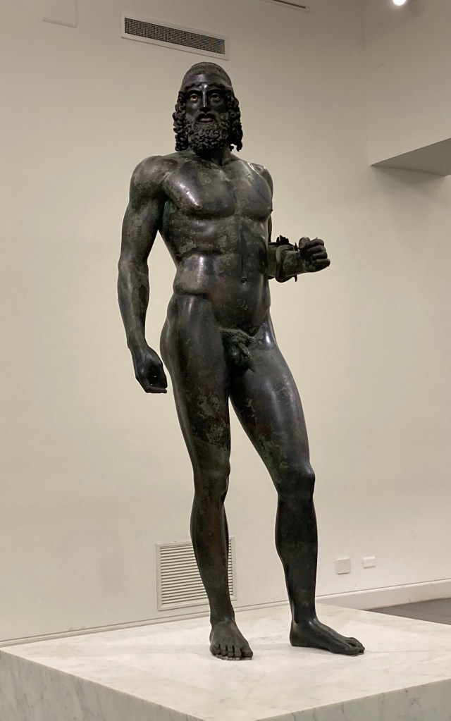
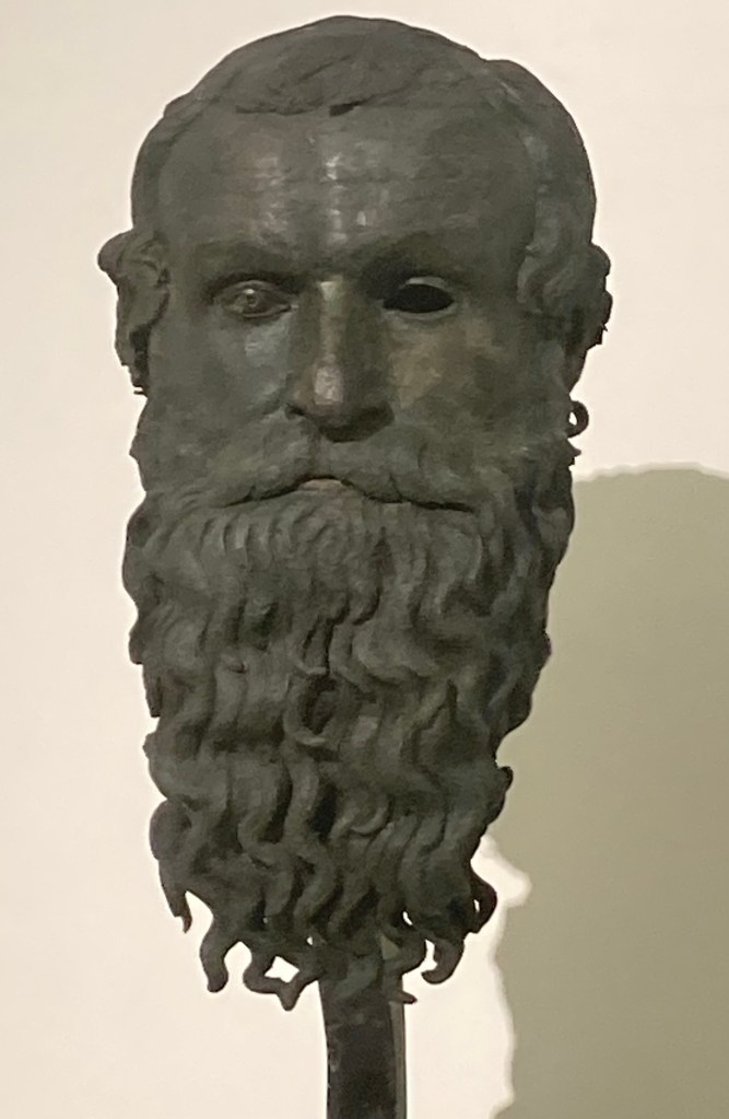
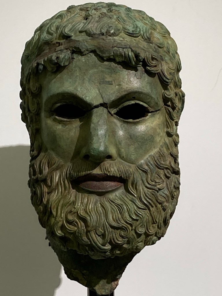
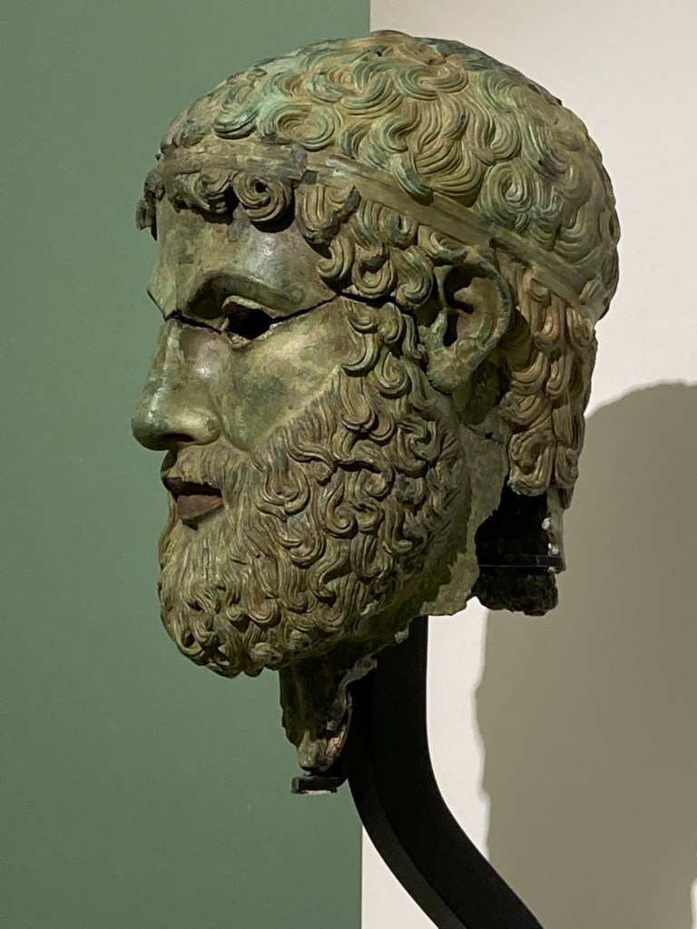
Before leaving mainland Italy we did visit the museum in Reggio Calabria 10 miles along the coast from the ferry port as it held two bronze figures that had been found locally in the Mediterranean and were on display in a hermetically sealed room to avoid contamination of the bronze.
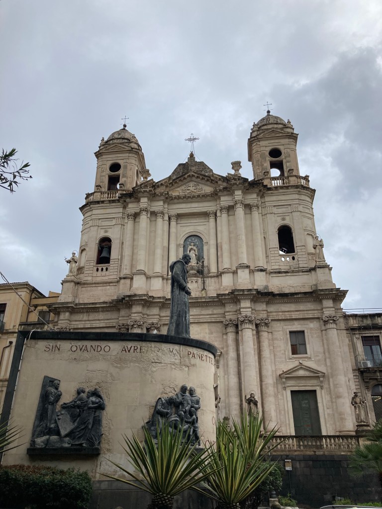
We had intended to explore the port town of Messina after the ferry docked to view the Astrological campanile and clock (maybe another day) but found the roads so congested we were just glad to fight our way out and ended up overnighting in Catania.
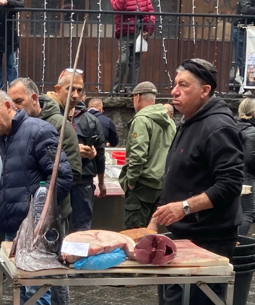
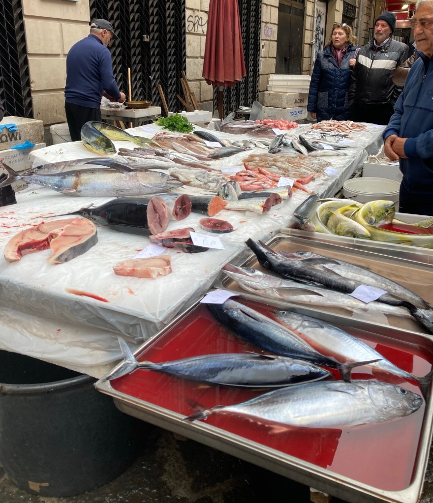
Catania was totally destroyed by an eruption of nearby Mt Etna in 1669 and an earthquake in 1693 but this allowed the city to be rebuilt to a new plan that created a fine baroque architectural location. In the morning after our arrival we took a leisurely walk into town and the market. Oh ! that we had markets like it in the U.K. everything looked so fresh and appetising but the fish market was out of this world.
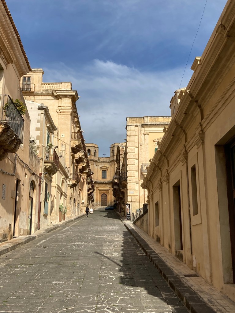
Having seen enough of busy towns we followed the coastline through the town of Noto which like Catania had been devastated in the historical earthquakes but had chose to rebuild itself with an upper and lower town. The wealthier families choosing to stay and rebuild the upper town in the style of baroque architecture. We walked around the upper town visiting a very interesting art exhibition.
Next was the seaside town of Punta Secca where the television series of Montalbano was filmed which was surprisingly small making it easy to find the house and restaurant featured in the series.
After a couple of stops further along the coast we decided to leave Sicily and head for home. But first we wanted to use our remaining time to see some of the Xmas markets that European cities are famous for as well as revisit a couple of favourite locations.
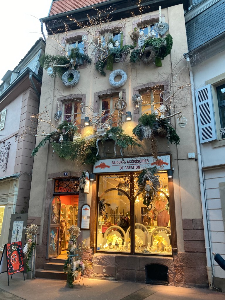
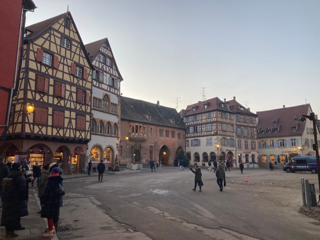
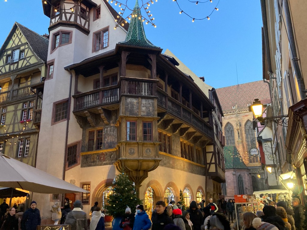
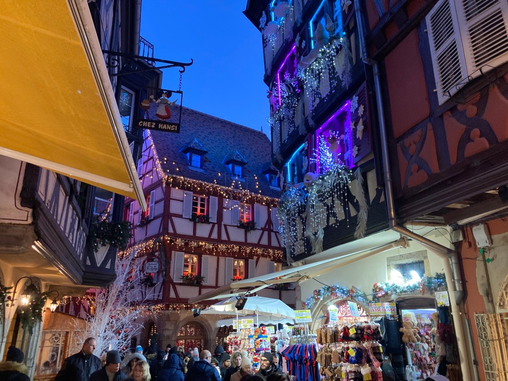
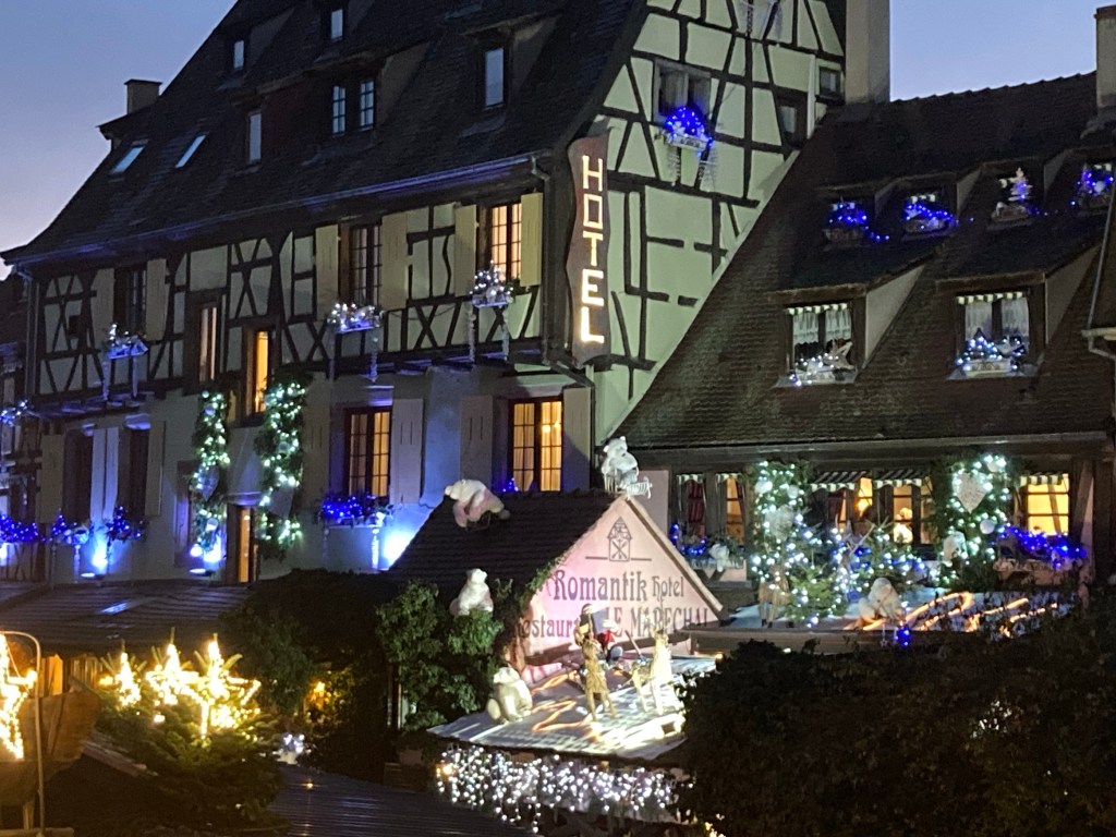
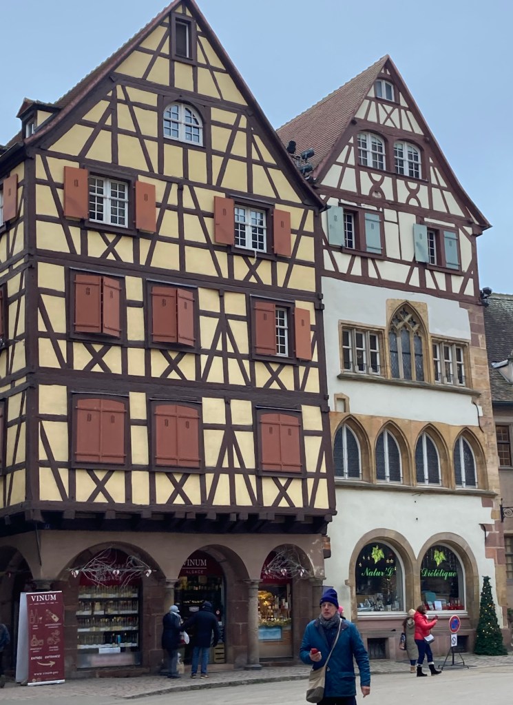
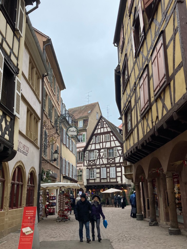
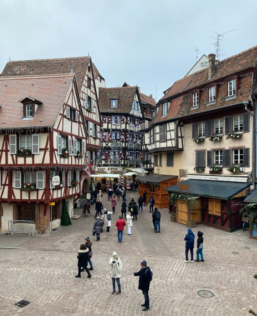
Therefore a ferry journey from Sicily to the northern Italian town of Genoa would begin our travels through the alps of Italy and Switzerland to the Alsace town of Colmar We had visited once before en route to Italy and found it an enchanting place dating back to the 14th century with canals and narrow streets and had promised ourselves to one day return. Our route home enabled us to keep that promise and at the same time to visit a vineyard in the nearby German town of Neustadt to purchase several boxes of really nice wine we had discovered on our outward journey.
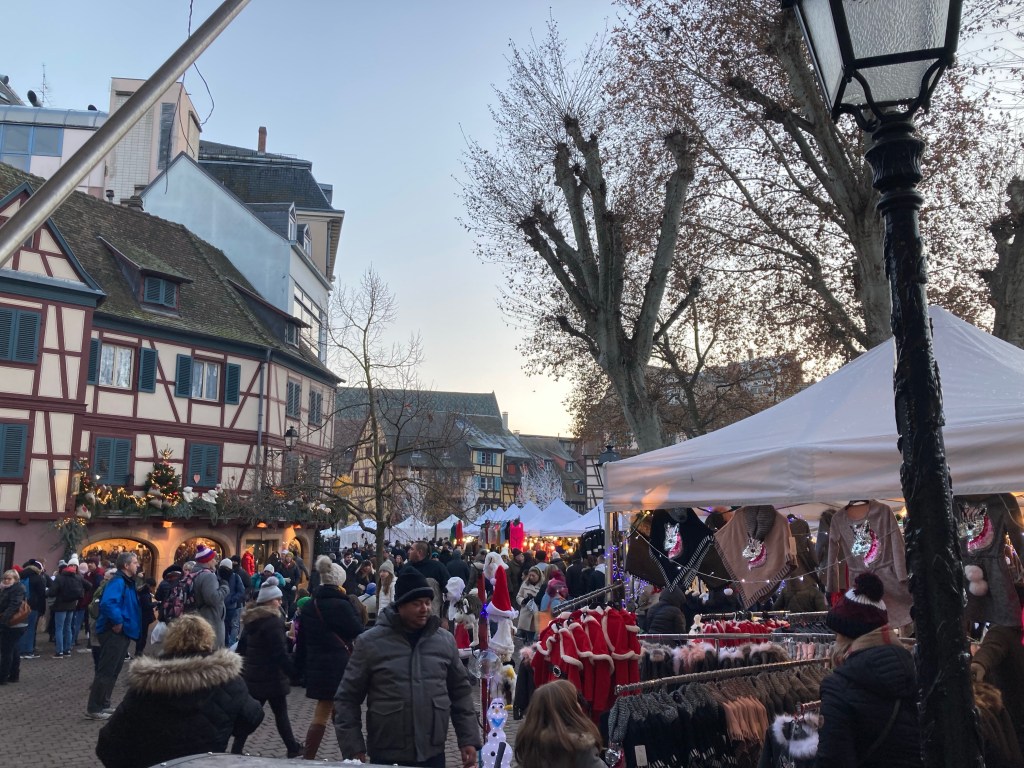
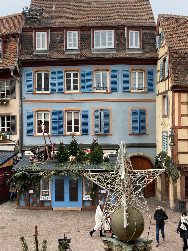
On arriving in Colmar we discovered a Xmas market in full flow with numerous coaches from Switzerland, Germany and Belgium all parked up on the edge of the old town which was dressed up in style for the occasion.
This was the first of three Xmas markets we had set out to visit with Cologne and Bruge to follow Colmar.
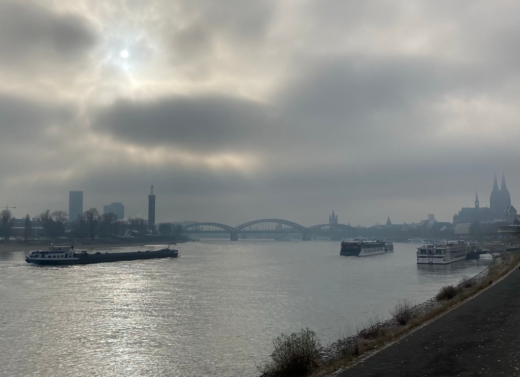
In Cologne we parked on the outskirts of the city centre alongside the Rhine but within walking distance to the Xmas markets. Walking alongside the river we realised how busy it was with commercial barges and river cruises. It was a very cold morning with temperatures as low as -10 and a heavy mist from which the cathedral spires eerily stood out. The layout of the markets appeared to be better organised and were a more pleasant experience than in Colmar.
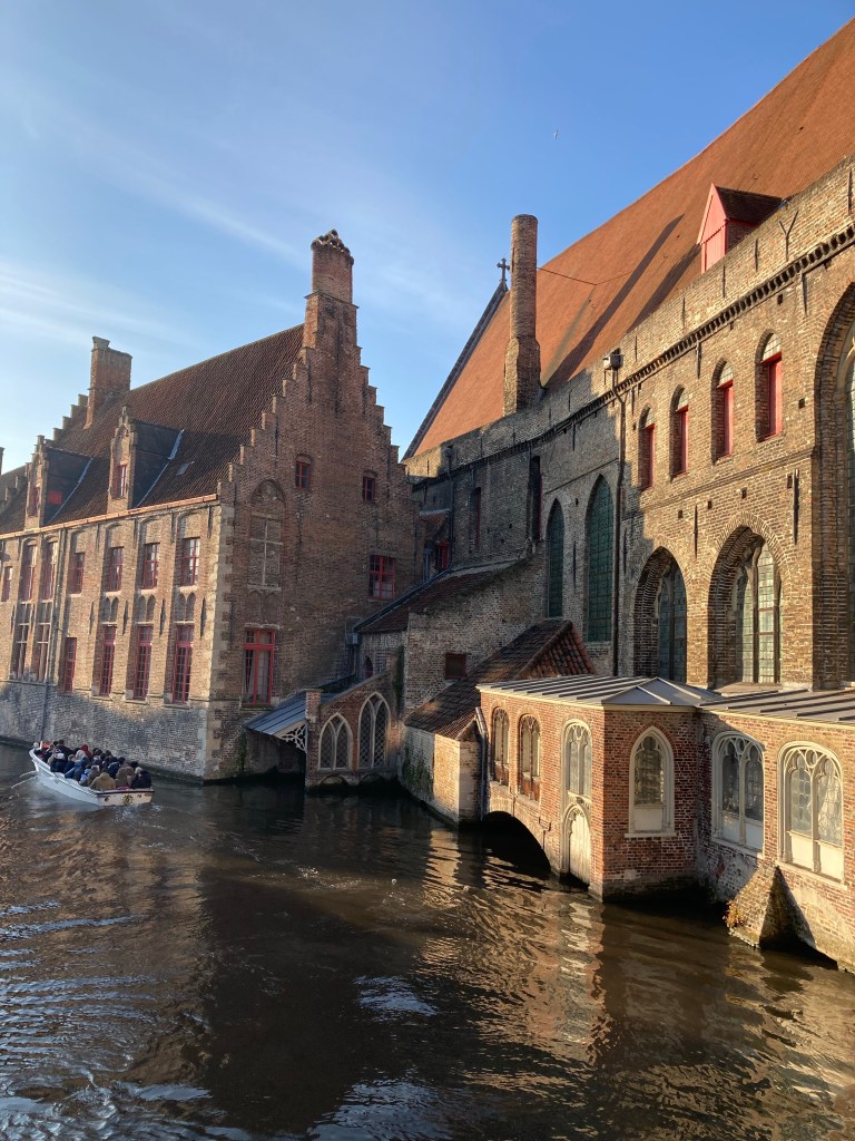
The last visit of our travels was to Bruge a place we had always wanted to visit after seeing the film “In Bruge”. We felt that the beauty of the town was lost in the hustle and bustle of the Xmas market and remains a place to which we will have to return.
And so our amazing and memorable journey ends and we hope that those who have followed this blog have enjoyed sharing our travels with us.
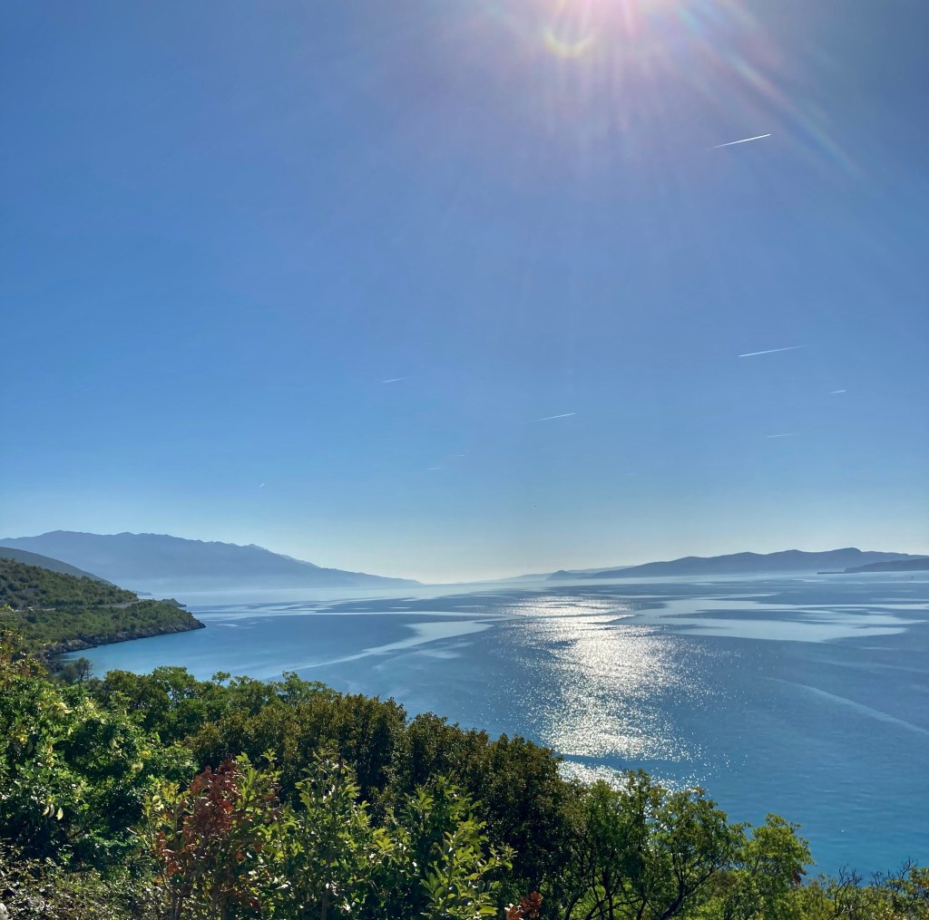
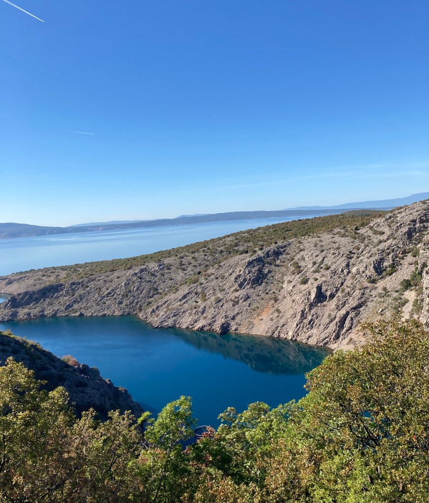
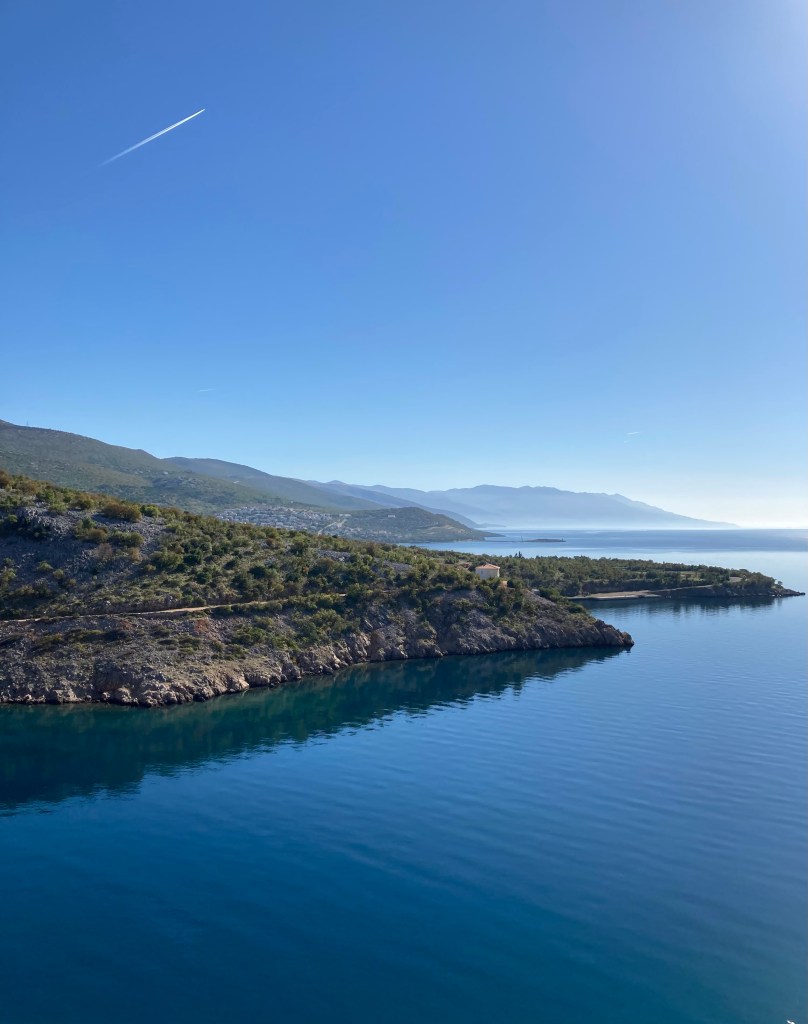
Our intention was to follow the Dalmatian coast to a small town called Senj before heading inland to the Plitivice National park. Unfortunately we could not find anywhere to park for the night so decided to carry on to the National park for an early morning start and get ahead of the crowds. Although the meander along the coast had added an additional two hours to our journey the stunning coastline made it worthwhile. It appeared to be a series of large wide inlets that reminded us of the ffords in New Zealand on a much larger scale and always hovering just above the water there was an eerie heat haze. Sadly I do not feel my photos truly capture the essence of the scenery.
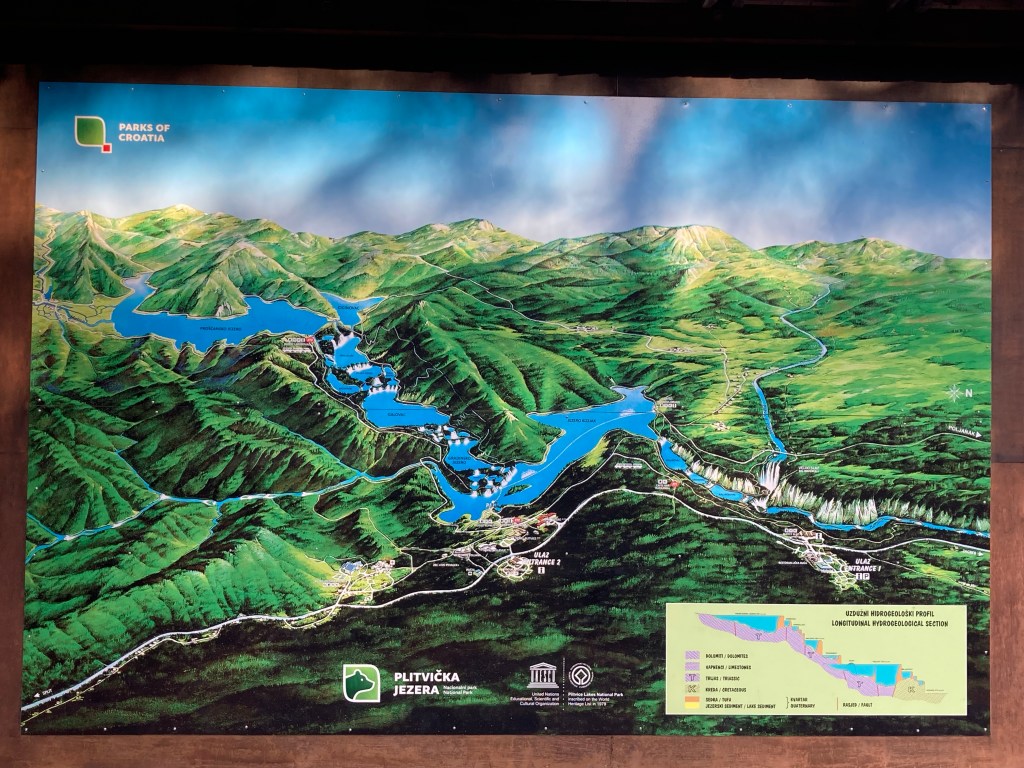
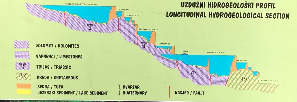
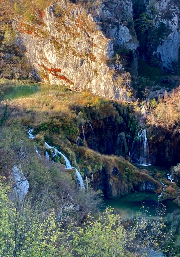
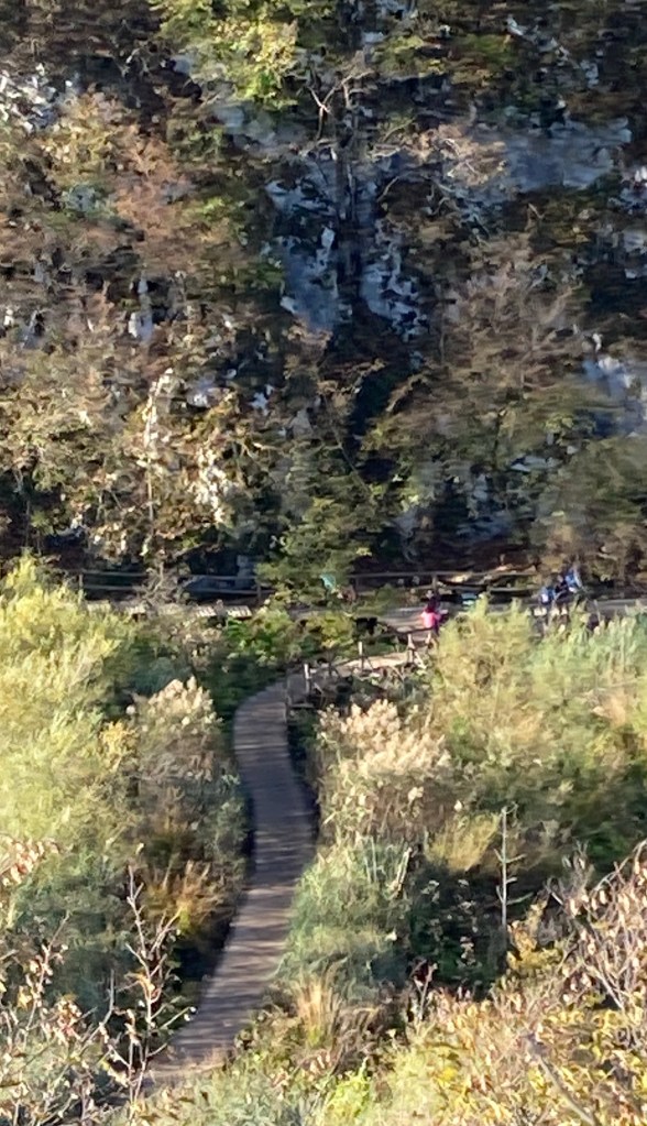
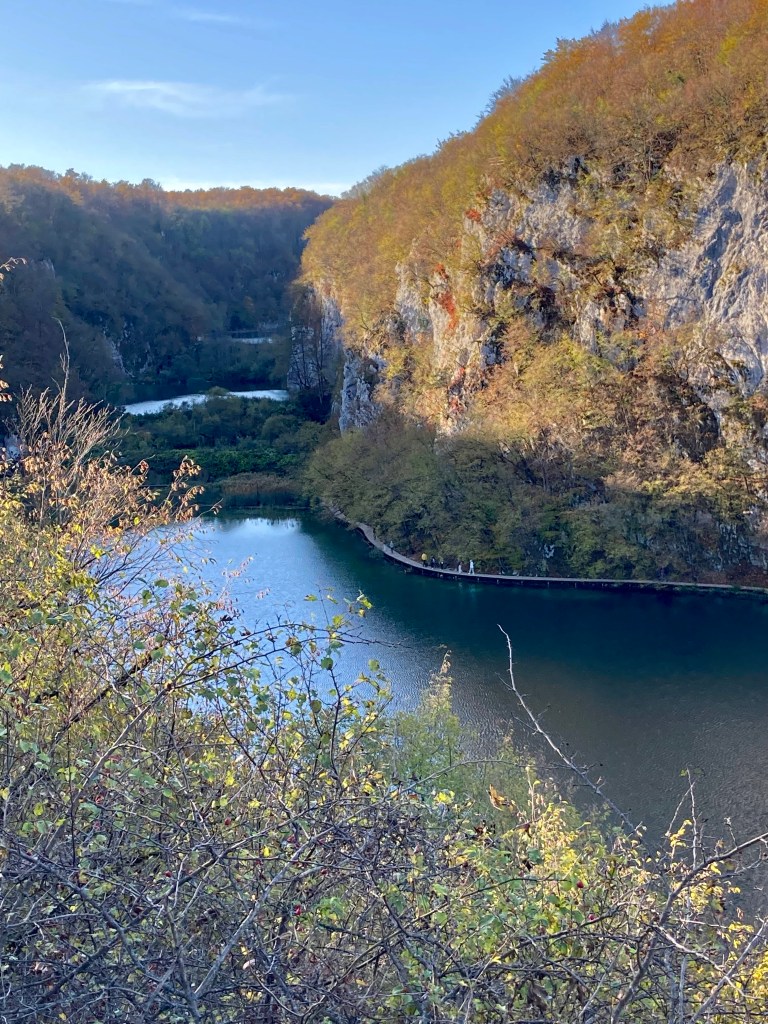
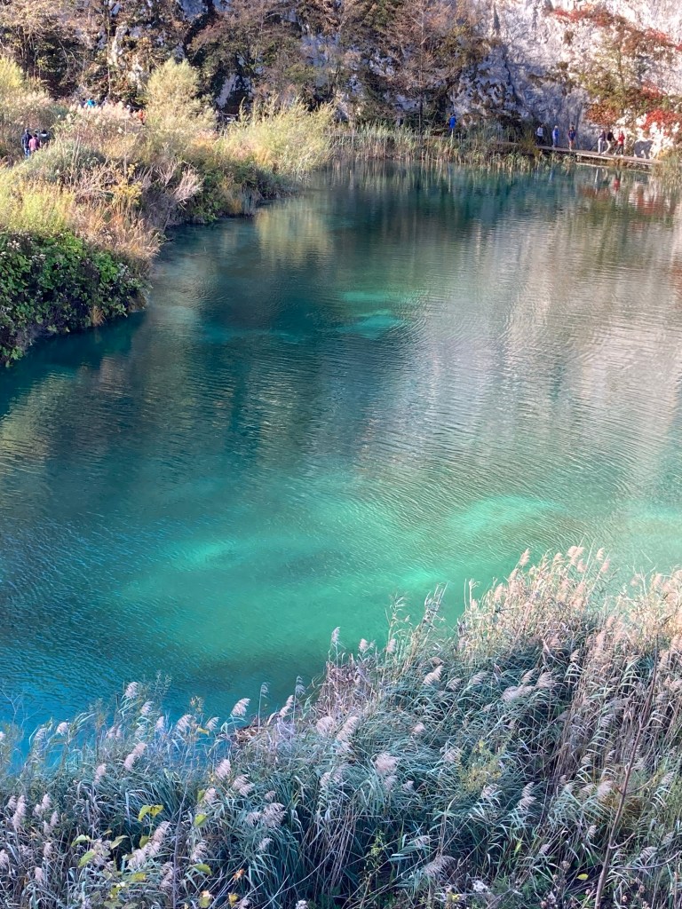
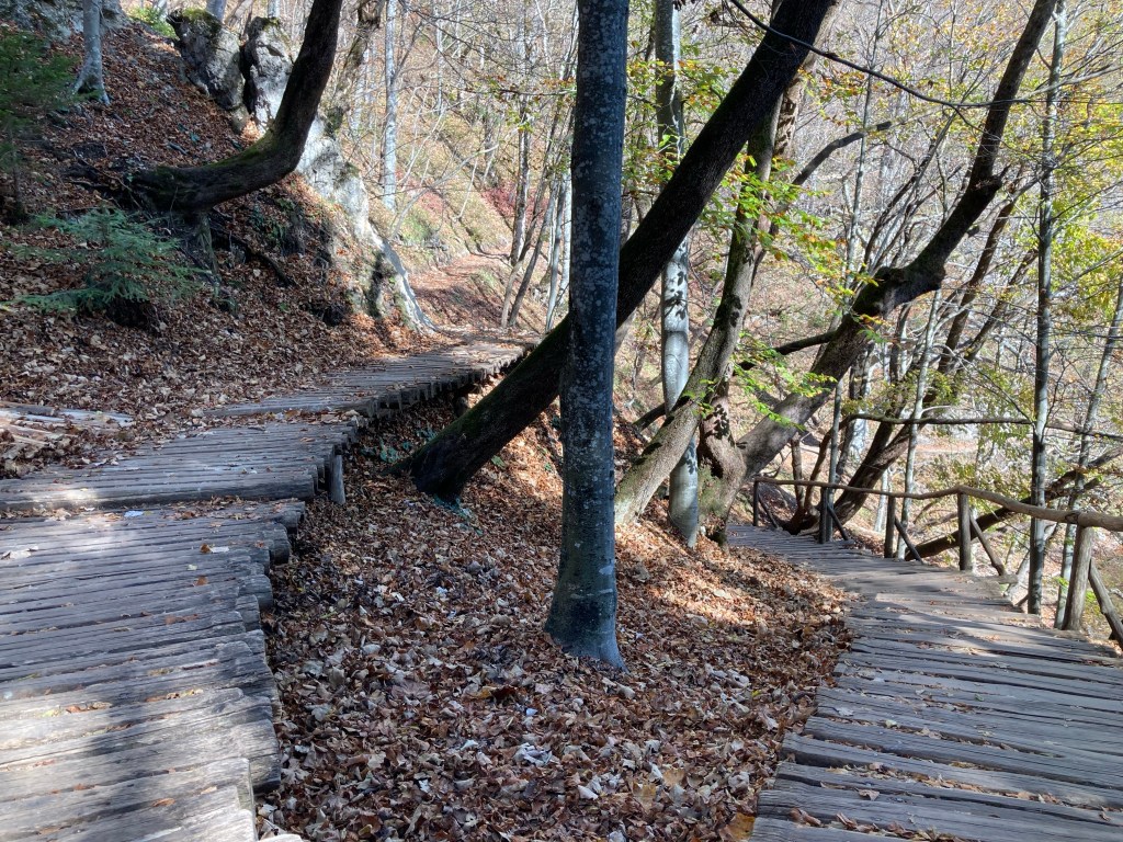
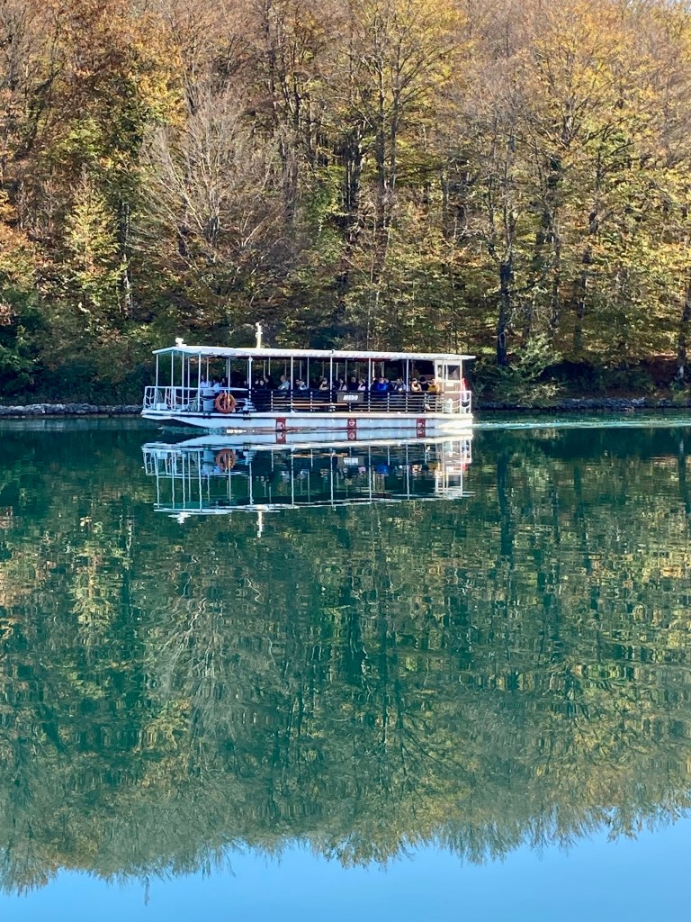
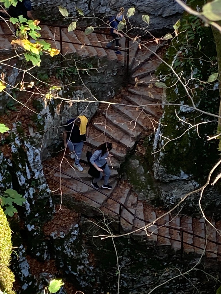
Despite our early morning start the next day we arrived at the car park to find it already nearly a third full? obviously we had underestimated the popularity of the Park which is a UNESCO world heritage site and one of the oldest and largest national parks in Croatia home to Brown bears, Lynx and the Grey wolf. The main attraction for walkers are the sixteen lakes linked by picturesque waterfalls split into upper and lower clusters surrounded by woodland.There are various footpaths to choose from around the lakes all very clearly marked giving you the choice of either the lower or upper lakes and for the hardy walkers you could cover the whole park.
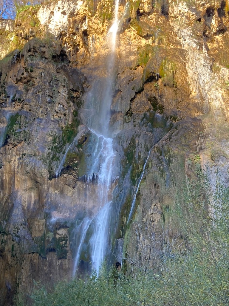
We opted for the lower lakes footpath B that was expected to take three hours. We followed the footpath which took us through woodland, and along boardwalks to various viewpoints to take in the numerous waterfalls for which the park is famous though at this time of year they were not in full flow which if they had been one could imagine would have been a spectacular sight, it also included a boat ride across the lake.
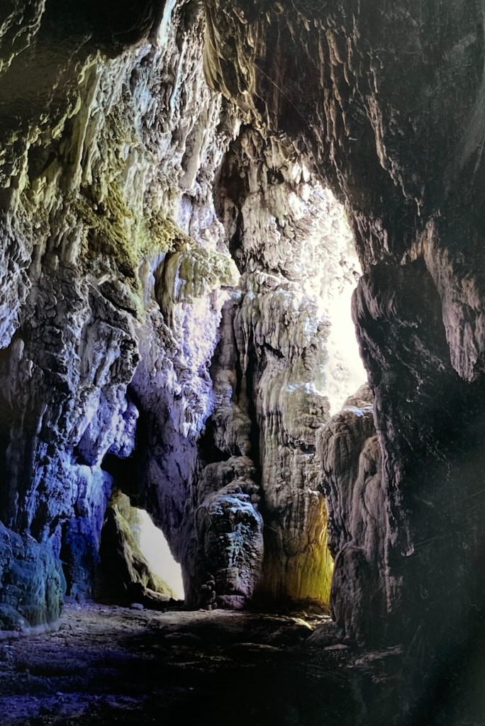
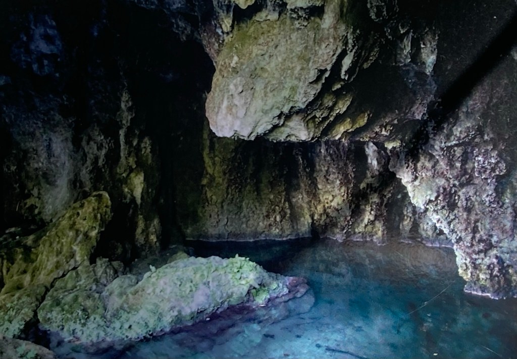
On disembarking we decided to take the train to the bottom of the upper lakes and explore more all in all our “three hour walk” became a rewarding full day walk in beautiful surroundings with the surprising discovery of one of the many caves.
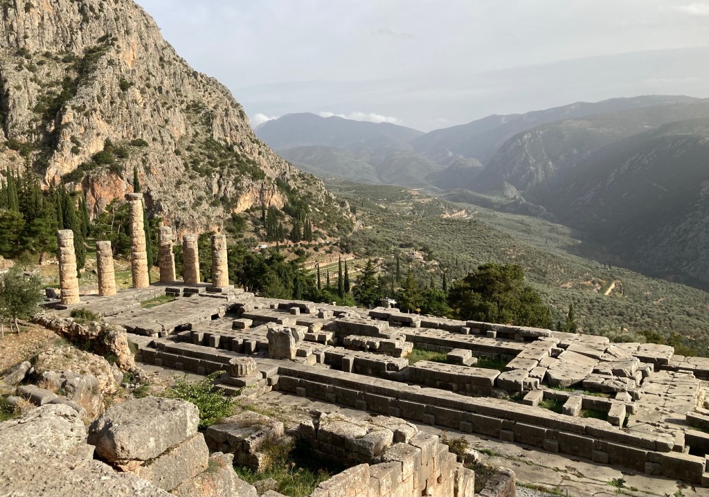
According to mythology Zeus had released two eagles at opposite ends of the earth and where they met was to be considered the centre of the earth and this was the site at Delphi.
The ancient Greeks believed that Delphi was where the god Apollo would speak to them through the Oracle. This was a female priestess over the age of fifty who had been selected to communicate with the gods and would sit on a tripod over a chasm in the earth that emitted “hallucinogenic”fumes causing her to go into a trance. Her unintelligible utterances to any pilgrims question would be translated into answers in verse by the high priest, and those answers would determine which battles to fight, whether to marry, what journeys to undertake and if business deals should be entered into.
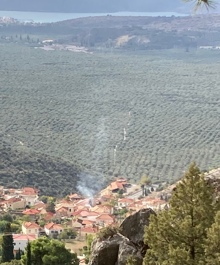
Built on the slopes of mount Parnassos overlooking a valley of cypress and olive trees that extend down to the Gulf of Corinth it’s location is truly awe inspiring and not easy to express in words. The ruins consist of numerous temples and other structures sprawling across the mountainside covering many acres some of which is still under exploration.
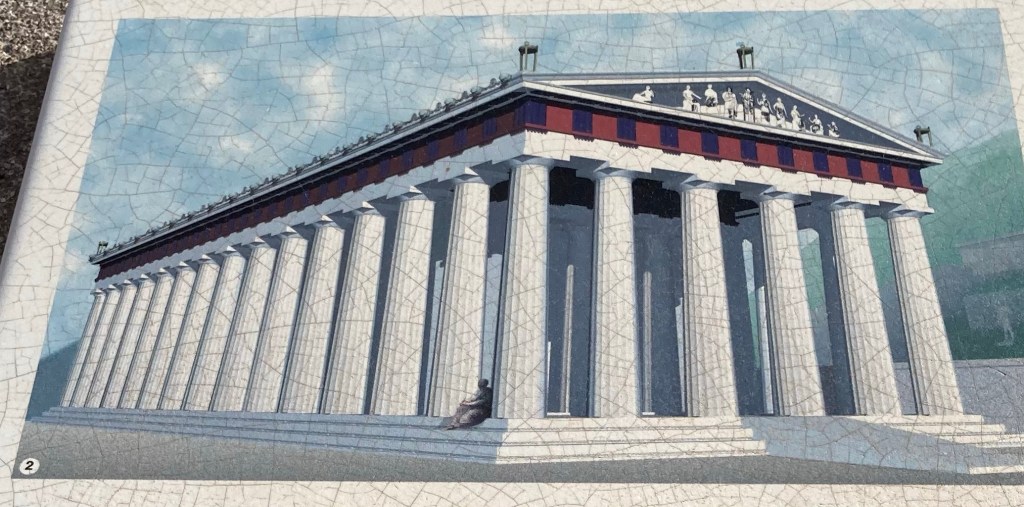
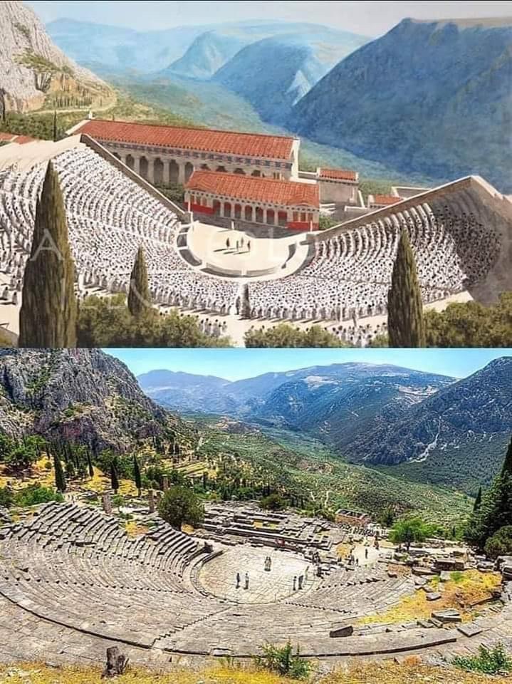
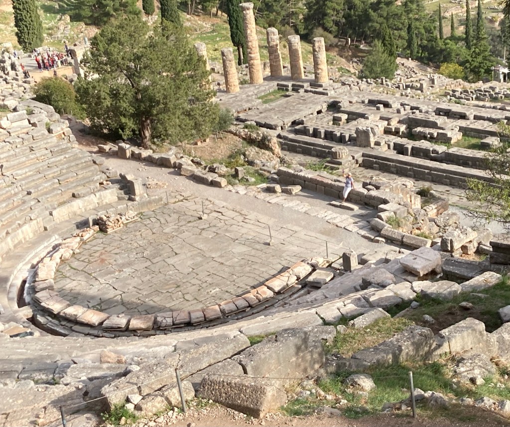
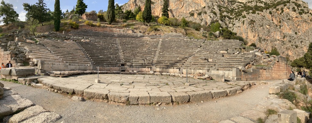
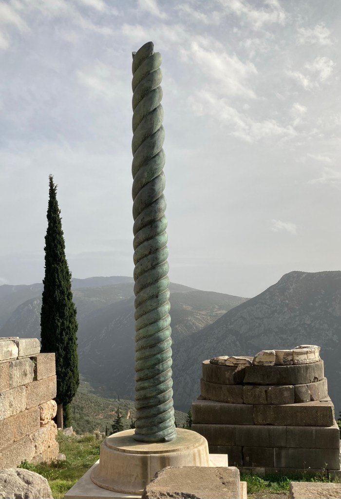
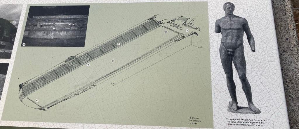
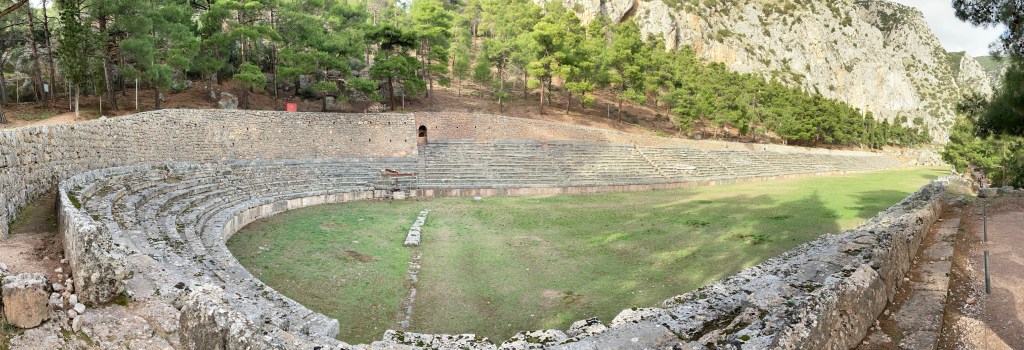
Valley of Delphi looking to the Gulf of CorinthValley of DelphiArtists impression of Apollo’s templeThe original access ramp to Apollo templeThe base area of the temple of ApolloArtist’s impression of the Amphitheatre with Apollo’s temple in background Amphitheatre with temple of Apollo in the background Delphi Amphitheatre The Athenian treasury temple Artist’s impression of Treasury templeTripod of the Plataeans a 7.5m high bronze 3 headed serpent which originally supported a solid gold tripod as shown in the reproduction imageThe Stadea home to the Pythian Games
It was easy to see why Delphi is the second most popular historical site in Greece.
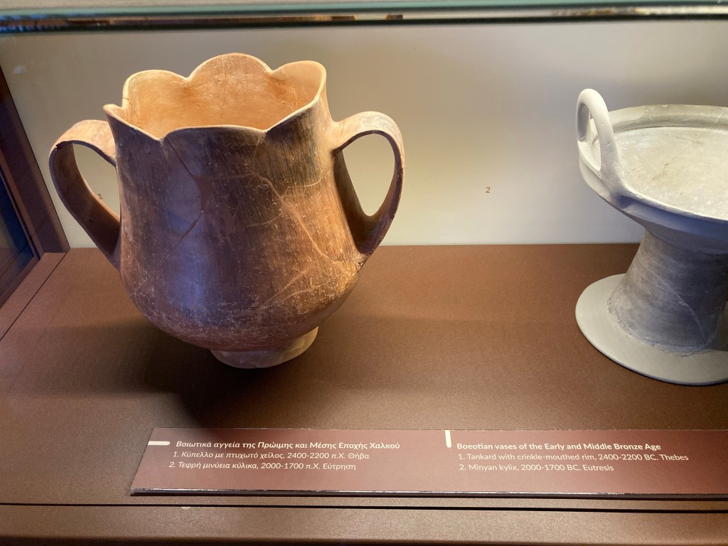
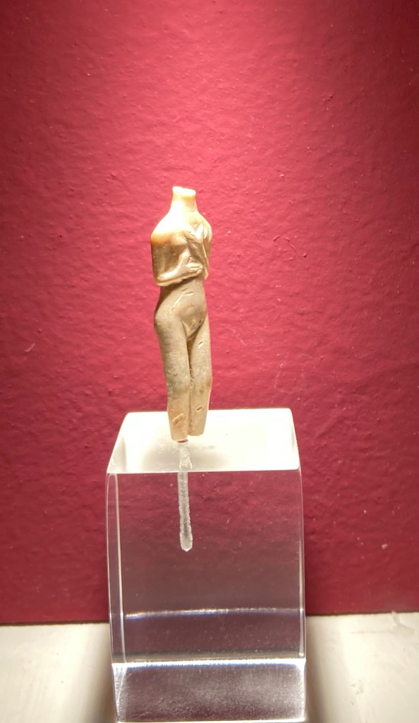
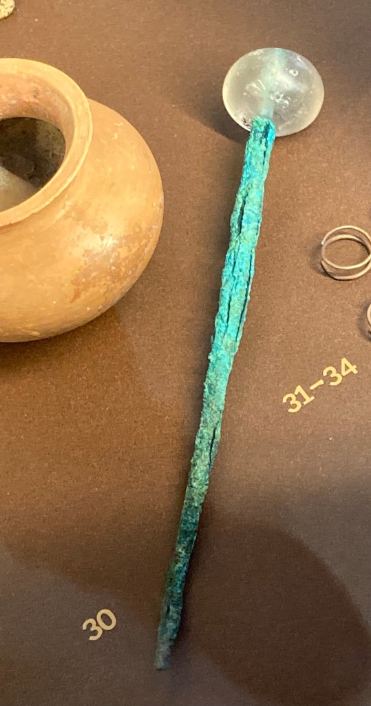
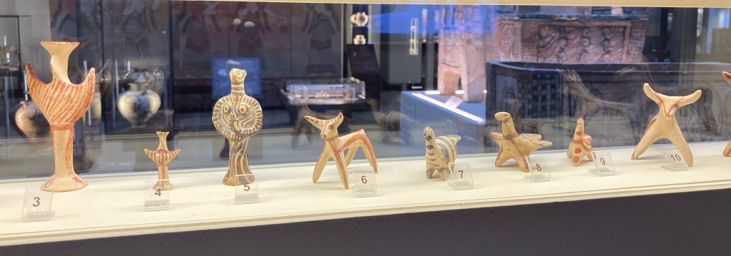
Thebes
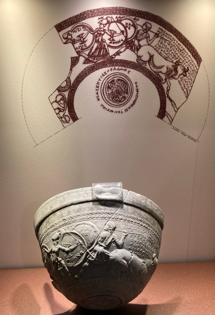
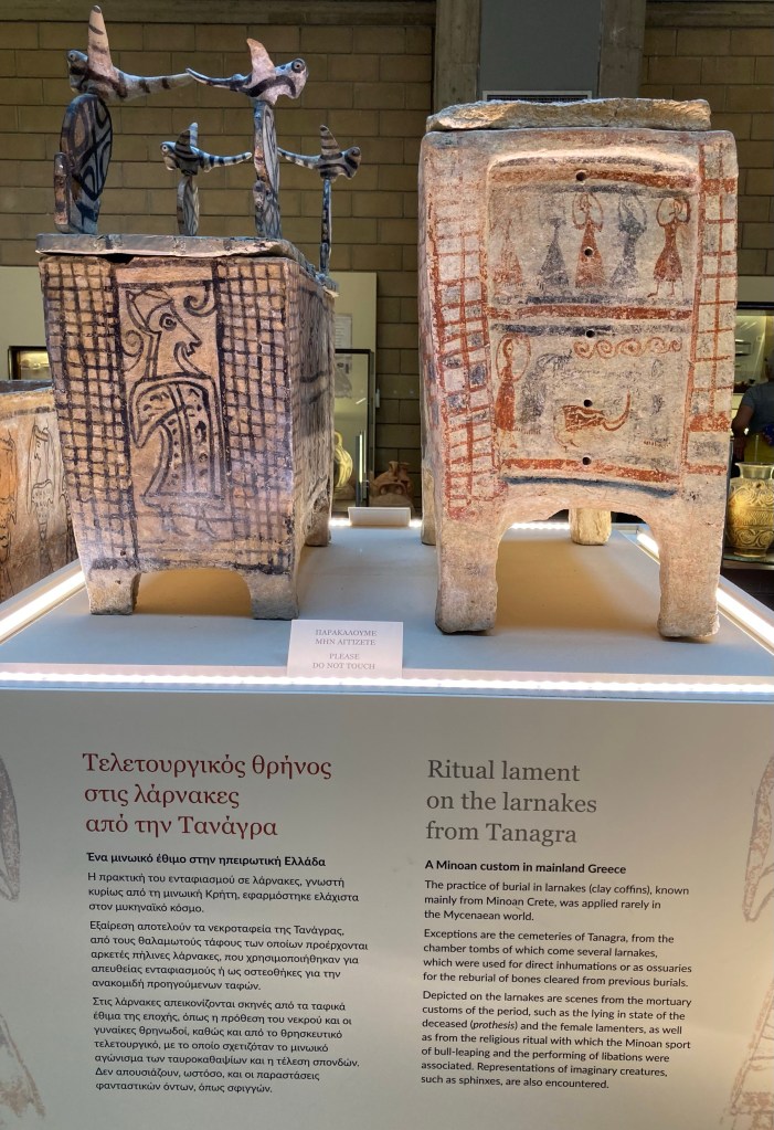
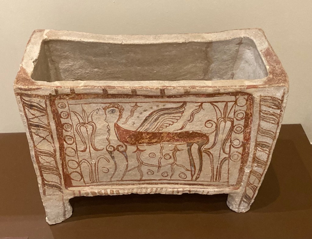
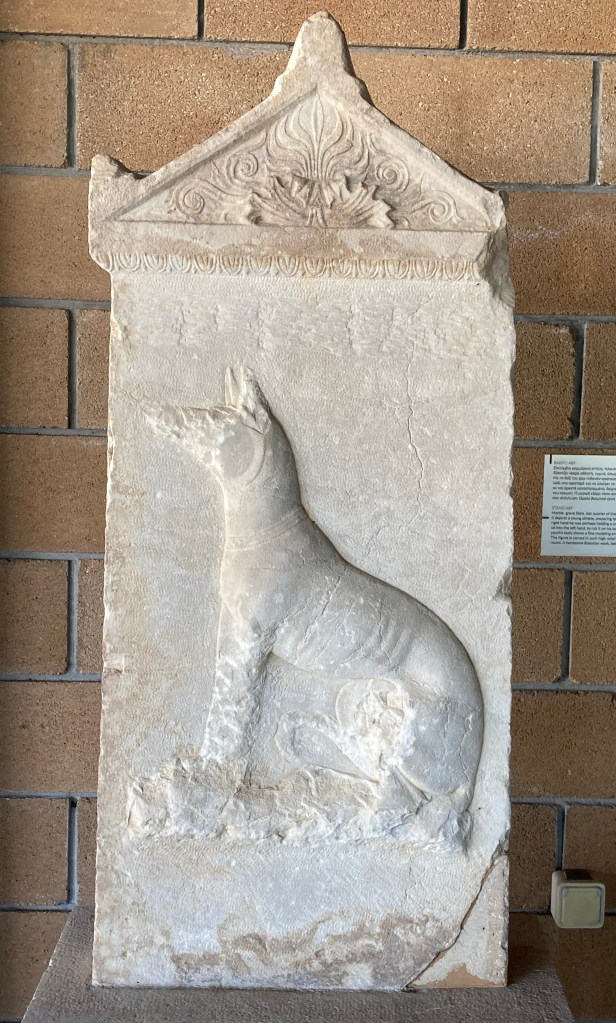
The museum in Thebes is one of the most important museums in Greece being home to many unique and archaeological finds covering from prehistoric to Byzantine times with the exhibits displayed in chronological order.
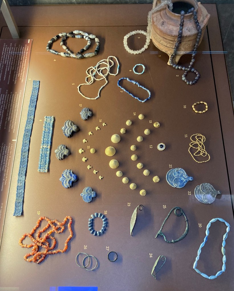
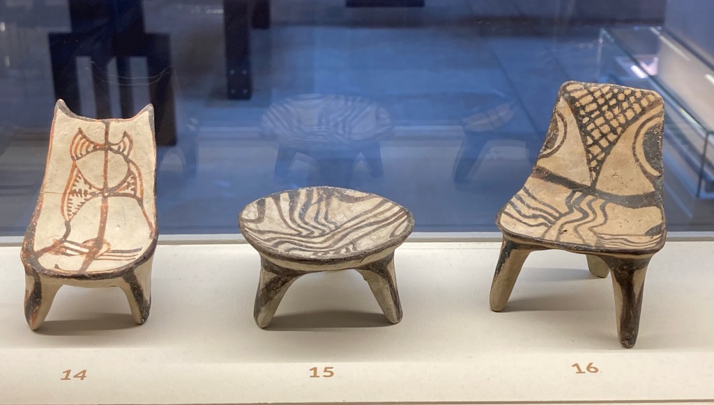
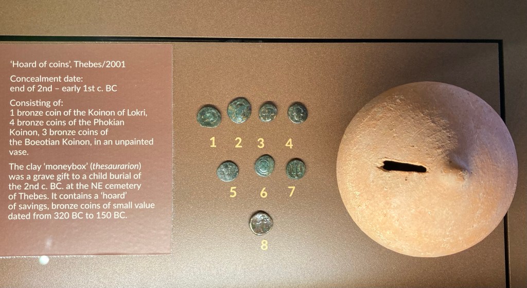
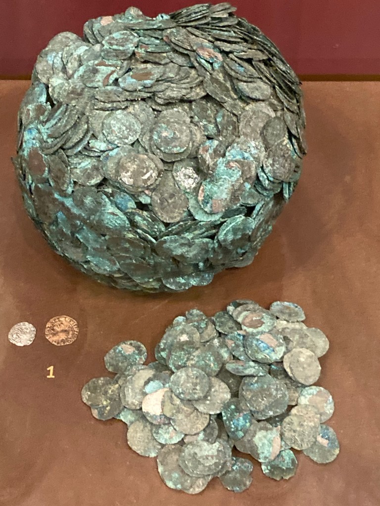
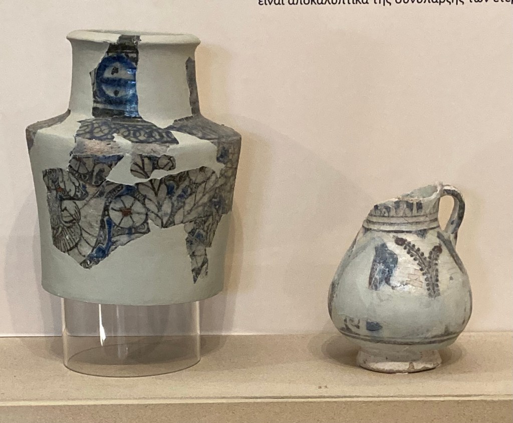
Bronze ware Bronze warePrehistoric artefactsIvory figurineBronze tools and their containerGold with lapis laziliDecorative Bronze pin with rock crystal head Child toysChild goods Decorative pot showing figure of man grating cheese into a bowlRare larnacaRare larnaca or burial chest Child’s toy figures Money box from child’s grave with hoard of small value coins given as gifts Bronze coins holding the shape of their bag that has long rotted away
Finally we find ourselves museum and archaeologically exhausted so have decided to spend the rest of our time in Greece chilling out around the coast with one final archaeological visit to Olympia. (one cannot come to Greece and not visit the starting point of the Olympic Games)